Silverdale Country Park Walk and Map
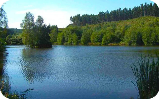
Silverdale Country Park is a scenic area near Newcastle Under Lyme, Staffordshire and is popular with walkers and nature lovers. The park was created on the former Silverdale Colliery and covers 83 hectares. Download the Staffordshire Walks app see your position on the Silverdale Country Park route maps as you walk.


150+ walks in Staffordshire. Search ‘Staffordshire Walks’ on your app store to download the app.

Photo © Jonathan Hutchins (cc-by-sa/2.0)
Silverdale Country Park
2.5 miles and 7.5 miles
This walk is a nice stroll around Silverdale Country Park near Newcastle-under-Lyme and Stoke-on-Trent. The pretty park was created on the former Silverdale Colliery and provides great views and a chance to enjoy nature and a variety of wildlife.
This second route option is an epic and varied adventure in the area to the west of Newcastle-under-Lyme and it actually explores three different parks - the Bateswood Nature reserve, the Apedale Community Country Park where you climb up the spinning wheel for some lovely views and finally the Silverdale community park. If you head clockwise around the route, you'll have to initially be careful on a short section of road walking before you then embark on a lovely adventure full of pretty countryside, hills, sweeping views, woodland, lakes and parks. This is along walk with lots of hills, so please go prepared with the appropriate clothing and refreshments for your journey. There is also a pub half way around the route that has a back garden with wonderful sweeping views over the Bateswood Nature Reserve.
Silverdale Country Park Walk 1 Route Map
Search ‘Staffordshire Walks’ on your app store to download the app and see your position on the map as you walk.

© OpenStreetMap contributors
Contains OS data © Crown copyright and database right 2021
More walks…