
Park Hall Country Park Walk and Map
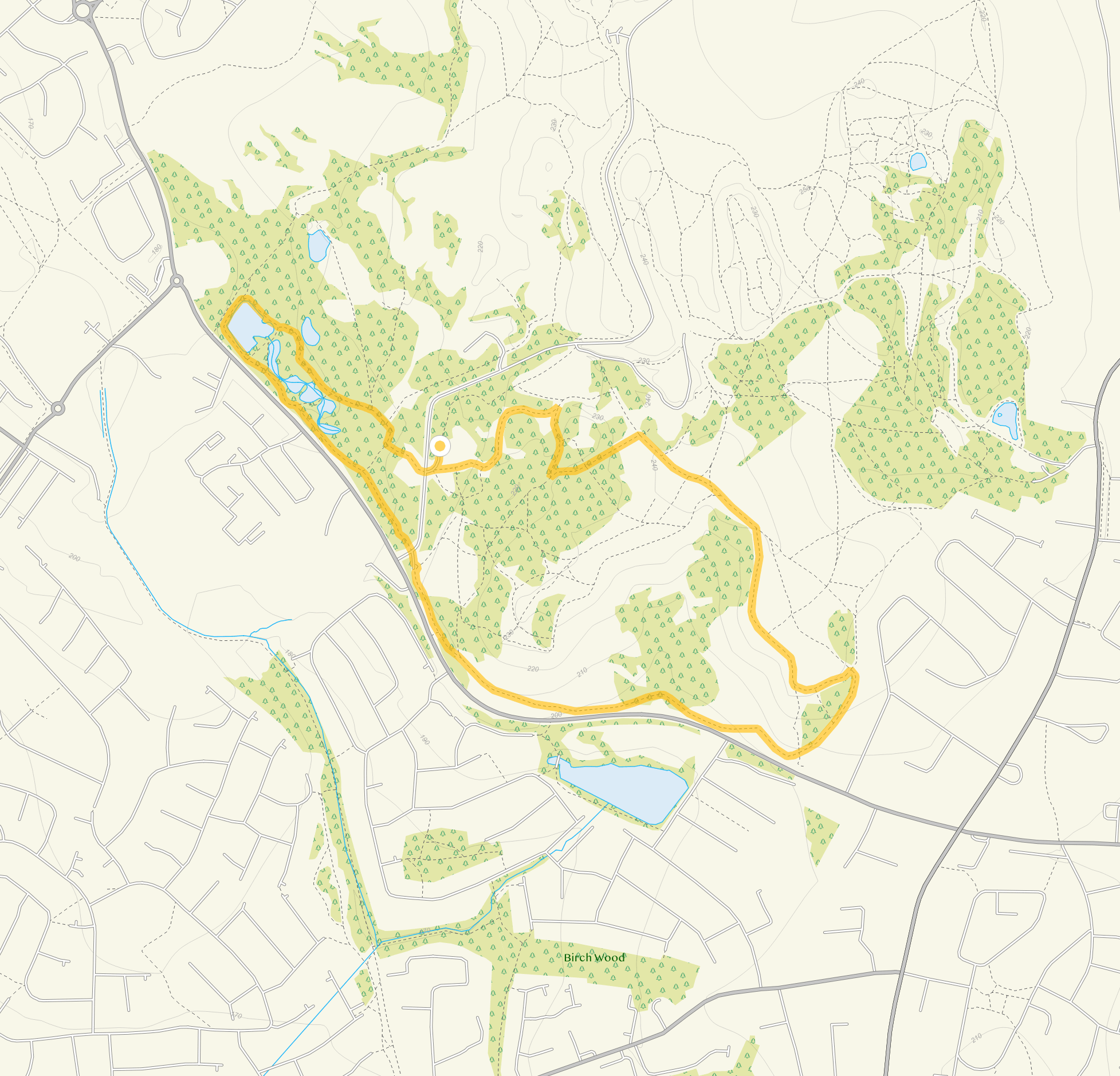
Park Hall Country Park near Stoke-on-Trent is a fantastic place for a walking adventure where you can enjoy numerous different species of fauna and wildlife. This set of Park Hall walks all start from one of three car parks in the park that we have featured on the app to help you navigate around this beautiful space. The walks range from just under a mile in length to 6.5 miles. Take a look at the map below to see the route for walk 4 and download the Staffordshire Walks app to see your position on the map as you walk.


150+ walks in Staffordshire. Download the app to see your position on the map as you walk.
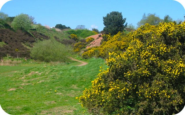
Photo © Phil Eptlett (cc-by-sa/2.0)
Park Hall Country Park
Park Hall walk 1
0.75 miles
The first route from this car park is a nice and short stroll around the pools of Lady Corner which boasts some pretty woodland walking and a large variety of aquatic wildlife around the ponds.
Park Hall walk 2
1 mile
The second route option from this car park heads in the opposite direction to the first route and instead takes you on a nice short walking loop through more open landscapes that enjoy some pretty views from the Park Hall Hill.
Park Hall walk 3
1.5 miles
This third route option is basically an extension to the second Park Hall route. As well as enjoying everything from the second route, it also takes you deeper into the park to enjoy the wonderful views from another hill called Ford Hill and also the wildflower meadows that are vibrantly colourful when they are in bloom.
Park Hall walk 4
2.25 miles
The fourth option from this car park is basically a longer walk that combines the hills and views of the third route option, with the woodland, ponds and aquatic wildlife of the first route option. This creates a lovely varied walk full of wonder and adventure in the south western section of the Park.
Park Hall walk 5
6.5 miles
This final route is an epic adventure around the entire Park Hall Country Park. You can do this walk from any of the three car parks that we have featured on the app and it basically takes you around all of the highlights of the park in one long and wonderful walk. This includes the dramatic Hulme Canyon, the wonderful pine forest of Pump Tree Wood, the pools at lady corner, the views from Park Hall Hill and the varied woodland strolling of Willot's Wood.
Park Hall Country Park Route Map (walk 4)
Download the Staffordshire Walks app to see your position on the map as you walk.
© OpenStreetMap contributors
Contains OS data © Crown copyright and database right 2021
More walks…

If you are looking for a lovely walk to Three Shires Head, this walk and route map starts at the village of Flash and is worth the hike.


Whitfield Valley Nature Reserve is one of the largest reserves in Stoke-on-Trent and includes a wide variety of wildlife and habitats. Here are 4 Whitfield Valley walks which can be found on the Staffordshire Walks App.

Chasewater Country Park in Staffordshire is a scenic beauty spot and popular with walkers, nature lovers and water sports enthusiasts. It has a lovely mix of different landscapes and activities to enjoy and is a great family day out.

Staffordshire has so many amazing and diverse walking areas to choose from including the spectacular Peak District and the magical forests of Cannock Chase. Here is a list of the best Staffordshire walks you can find on the app which includes over 150 Staffordshire walks to choose from. Download the app to find your perfect walks and see your position on the route maps as you walk.

Here are some of our top places to walk in and around Stoke-on-Trent. Do you love walking? There are some wonderful walks in Staffordshire ready to be discovered. All of these walks can be found on the Staffordshire Walks App.

Hanchurch Woods is a scenic woodland area close to Stoke-on-Trent, Staffordshire. It has a number of lovely walks and a picnic area, surrounded by wonderful wildlife. Wandering through Hanchurch Woods allows you to experience nature and the beautiful Staffordshire countryside. Here are 5 Hanchurch Woods walks which can be found on the Staffordshire Walks App.

This walk can start from either the Seven Springs car park or Brockton Coppice car park. It’s a strenuous but wonderful walk that takes you along woodland paths, past the Cannock Chase stepping stones and also through the scenic Sherbrook Valley and over into Abraham's Valley.

If you are looking for a lovely walk around Cannock Chase and over the Stepping Stones, here is a walk and route map for you to enjoy.

Dovedale is a glorious and popular place to go walking. Here is a Dovedale walk route map and details of six walks we have on the Staffordshire Walks app. Download the app to see your position on the map as you walk.

Park Hall Country Park is a fantastic place for a walking adventure where you can enjoy numerous different species of fauna and wildlife. Download the Staffordshire Walks app to see your position on the map as you walk.

If you want to walk through the beautiful Manifold Valley, here is a route map starting from Hulme End. We have seven Manifold Valley walks on the Staffordshire Walks app, download the app to see your position on the map as you walk.

Kinver Edge is a high heathland and woodland in South Staffordshire that’s also home to the famous Rock Houses and an iron age hill fort. There are some steep inclines on these walks but you will be rewarded with some lovely views.

Barton Marina is a home for over 300 narrowboats and is linked to the Trent and Mersey Canal. The marina also offers a range of shops, restaurants and a number of lovely walks including the National Forest Silver Circuit.

Rudyard Lake is one of the most scenic beauty spots in Staffordshire and a very popular place to visit for both tourists and water sports enthusiasts. Rudyard Lake as a wonderful mix of different landscapes and here is a walk and route map. Download the Staffordshire Walks app to see your position on the map as you walk.

If you fancy a lovely stroll along the canal then this walk is for you. Here is a walk and route map for Fradley Junction. Download the Staffordshire Walks app to see your position on the map as you walk.

The 12th century Croxden Abbey used to be the home to Cistercian monks. Here is a route map for a walk that starts from outside Croxden Abbey in Staffordshire. Download the Staffordshire Walks app to see your position on the map as you walk.

Dimmingsdale is a lovely area for walking. Here is a route map for walk two and more walks are available in the app. Download the Staffordshire Walks app to see your position on the map as you walk.

This Cannock Chase walk takes you through Broctons Coppice and along Abraham's Valley where you will enjoy heathland, woodland paths and open countryside. Download the Staffordshire Walks app to see your position on the map as you walk.

This lovely walk and route map takes you around the Castle Ring hill fort and then deeper into Cannock Chase to explore the forest and wildlife. Download the Staffordshire Walks app to see your position on the map as you walk.
Here is a lovely family friendly walk and route map around Fairoak Pools, Cannock Chase. Download the Staffordshire Walks app to see your position on the map as you walk.

This is our longest Cannock Chase walk which starts from the visitor centre. It's an epic trek with a bit of everything including woodland, lakes, wildlife, hills, roads and lots of glorious open Staffordshire countryside to enjoy. Download the Staffordshire Walks app to see your position on the map as you walk.

Here are 5 of the best Cannock Chase walks with route maps. Cannock Chase really is a magnificent place to explore and offers a wonderful day out with diverse walking areas with something for everyone. We have lots of Cannock Chase walks within the Staffordshire Walks app and here are five of the best for you to enjoy.

Silverdale Country Park is a scenic area near Newcastle Under Lyme, Staffordshire and is popular with walkers and nature lovers. The park was created on the former Silverdale Colliery and covers 83 hectares. Download the Staffordshire Walks app see your position on the Silverdale Country Park route maps as you walk.

This is a lovely short walk around Westport Lake on a level footpath. The walk takes you around the large lake where you can watch the various waterfowl and enjoy a nice stroll through the woodland.

Highgate Common Nature Reserve is owned by the Wildlife Trust and is an ancient lowland heath with a network of paths crossing the woodland and heathland. Download the Staffordshire Walks app see your position on the Highgate Common route map as you walk.