Staffordshire Walks

Walks in Stoke-on-Trent

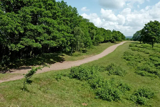
Whitfield Valley Walk, Staffordshire
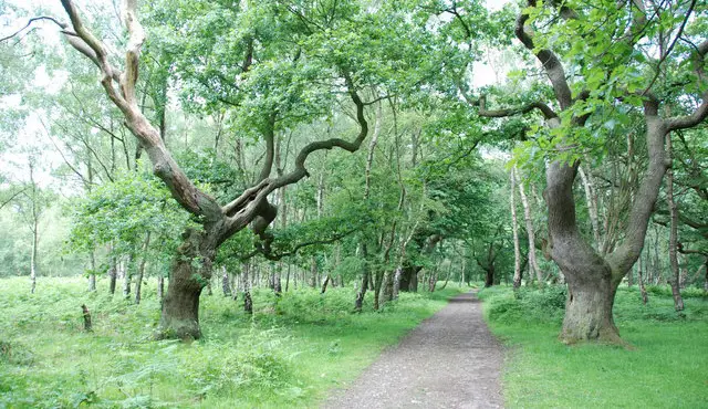
Whitfield Valley Walk · Photo: Russ

Do you love walking? There are some wonderful walks in Staffordshire ready to be discovered. Here are some of our top places to walk in and around Stoke-on-Trent. All of these walks can be found on the Staffordshire Walks App.

Download the Staffordshire Walks App to follow these routes with real-time GPS navigation.

Download on the App Store Get it on Google Play

On a computer? Scan the QR code with your phone's camera to get the Staffordshire Walks app.

Walk distance
½ miles
Time
30 mins
Route type
Circular

Whitfield Valley Nature Reserve is one of the largest reserves in Stoke-on-Trent and includes a wide variety of wildlife and habitats.

Here are 4 Whitfield Valley walks which can be found on the Staffordshire Walks App.

View the walk and route map
Walk distance
1¼ - 2¼ miles
Time
30 mins - 1 hour
Route type
Circular

Apedale Country Park is a lovely 454 acre country park near Stoke-on-Trent and is the newest country park is Staffordshire. These walks explore a fascinating landscape transformed from its mining past into rolling meadows and young woodland.

With a choice of a shorter family-friendly loop or a longer route that ventures further into the park, you’ll enjoy good surfaced paths, gentle hills and plenty of opportunities to spot wildlife along the way.

View the walks and route maps

Walk details

Westport Lake

Walk distance
1¼ miles
Time
30 mins
Route type
Circular

Westport Lake in Staffordshire is near Stoke-on-Trent and is a popular beauty spot for walkers and nature lovers. It has a visitor centre and cafe with a lovely waterside terrace if you want to stop for refreshments.

View the walk and route map
Walk distance
¾ - 6½ miles
Time
30 mins - 3.5 hours
Route type
Circular

Park Hall Country Park is a great place for walking and offers a lot to see including lakes, heathland and dramatic sandstone canyons. It’s a national nature reserve and not too far from Stoke-on-Trent, we have a number of walks around Park Hall Country Park on the App.

This set of Park Hall walks all start from one of three car parks in the park that we have featured on the app to help you navigate around this beautiful space.

The walks range from just under a mile in length to 6.5 miles.

View the walks and route maps

Walk details

Hanley Park

Walk distance
1½ miles
Time
30 mins
Route type
Circular

A nice family friendly stroll around Hanley Park which is in the heart of Stoke-on-Trent. It's a short and easy walk that takes past playgrounds and the pavillion, over the canal and around the lake. It's also on solid paths throughout, so it's a suitable walk for buggies and wheelchairs.

View the walk and route map

Walk details

Pump Tree Woods

Walk distance
½ - 6½ miles
Time
30 mins - 3.5 hours
Route type
Circular

The first route is a nice and short walk around the Pine Tree woodlands of Pump Tree Wood that was planted in the 1960's to mask some of the quarrying activity that was done at the time.

The second route option from the Pump Tree Woods car park is basically an extension of the first route that takes you deeper into the park and on a stroll around Skinners Canyon.

This third option is a further extension of the Pump Tree Wood walk that still enjoys the pine tree woods and pond from the first two routes, but then also ventures deeper into the Park Hall Country Park and visits the impressive Hulme Quarry with it's dramatic landscapes.

View the walks and route maps

Walk details

Willots Wood

Walk distance
1¼ - 6½ miles
Time
30 mins - 3.5 hours
Route type
Circular

The first route from this car park is a lovely circular walk around Willot's Wood which is a deciduous woodland containing a wide variety of native British trees and is not too far Stoke-on-Trent. You can expect to see Common Oak, Silver Birch, Hazel, Hawthorn, Rowan, Holly and a vast carpet of Bluebells in the spring.

This second walk is a longer adventure that packs two delightful punches. If you head anticlockwise, you'll first enjoy the wonderful varied woodland of Willot's Wood as in the first route. However, the second half of the walk then takes you on an adventure deeper into the Park Hall Country Park until you reach the Hulme Canyon for a stroll full of dramatic scenery.

View the walks and route maps
Walk distance
2½ miles
Time
1 hour
Route type
Circular

We have 2 walks at Silverdale Country Park near Newcastle-under-Lyme and Stoke-on-Trent. The first is a short stroll around the park and the second in an epic and varied adventure that explores three different parks.

View the walk and route map
Walk distance
1¼ - 2¼ miles
Time
30 mins - 1 hour
Route type
Circular

The first walk is a short circular walk around the National Trust's Downs Bank which is located to the south of Stoke-on-Trent. Wander through a little wilderness of woodland and heathland and a climb up the hill to be rewarded with wonderful views across the surrounding countryside.

This is a slightly longer walk that takes you around the edges of Downs Bank and up the hill for panoramic views across the Staffordshire countryside.

View the walks and route maps

Navigate the walks

Staffordshire Walks App

Download the Staffordshire Walks app

It's like sat-nav, but for footpaths.

Choose a walk and follow the pointer showing your live position on the route map, so you always know you're on the right path.

The app works without a phone signal, so you can keep following the route wherever the walk takes you.

Download the app

Download on the App Store Get it on Google Play

On a computer? Scan the QR code with your phone's camera to get the Staffordshire Walks app.

Staffordshire Walks app showing the walker's live position on a route map

Designed to be simple

  • Choose a walk and follow the pointer
  • See your live position on the route map
  • Works without a phone signal
  • Includes 150+ Staffordshire walks
  • Free one-month trial
  • Available for iPhone and Android

Explore the county

Staffordshire walks map

Map data © OpenStreetMap contributors

Search Staffordshire walks

See where the walks start, explore the area and tap a pin to find a route for your next adventure.

Search Staffordshire walks
Expanded route map for Whitfield Valley Nature Reserve