

Gloucestershire Walks

Tintern and Offas Dyke Walks & Route Maps

Tintern and Offas Dyke walk, Gloucestershire
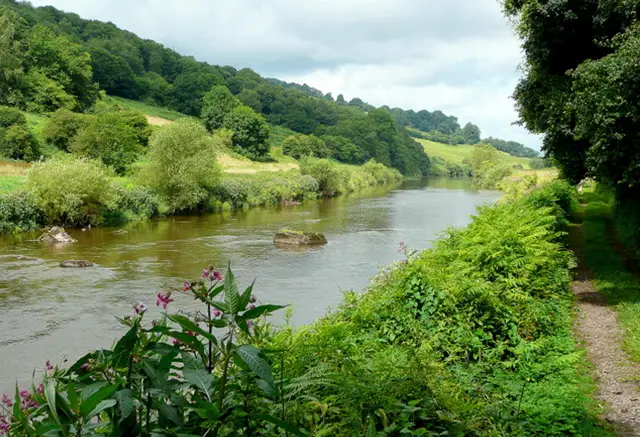
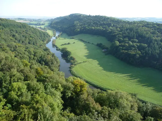
Tintern and Offas Dyke · Photo: Philip Halling

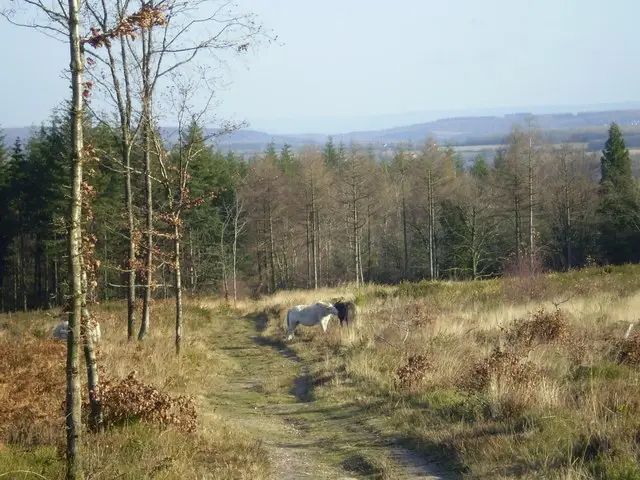
These walks begin in the historic village of Tintern beside the magnificent Tintern Abbey, before heading out into the dramatic landscape of the Wye Valley.

The routes range from a shorter circular stroll to longer, more demanding adventures that climb high above the River Wye, including sections of the famous Offa’s Dyke Path and the striking viewpoint known as the Devil’s Pulpit. Expect steep hills, wonderful woodland and countryside scenery, and a couple of welcoming pubs along the way to refuel after the climb.

Download the Gloucestershire Walks App to follow these routes with real-time GPS navigation.

Download on the App Store Get it on Google Play

Walk information

Tintern and Offas Dyke Walk 1

Walk distance
3½ miles
Time
2 hours
Route type
Circular

A lovely walk in Tintern crossing the River Wye. The walk does start in Monmouthshire however you cross back over to Gloucestershire for a large section of the walk.

The circular walk is shorter than the second Tintern route and there is less woodland walking and more open countryside to enjoy. It's not quite as steep as the second walk but there are still steep inclines and lots of energy will be required.

This walk will also take you past pubs en-route and you will begin at the Tintern Abbey.

Tintern and Offas Dyke Walk 1 4.4 Ratings and reviews 5 ratings · 4 reviews

Based on 5 user ratings

Community feedback

Overall rating4.4

A very popular walk

Dog friendly3.8 / 5
Path condition4.2 / 5
Buggy friendly1.4 / 5
Wheelchair friendly0.8 / 5
Toilet facilities2.8 / 5
Pub or café3.6 / 5
Route accuracy4.0 / 5
ClimbingSome climbing
LivestockRarely any livestock
StilesA stile or two
Mud levelBoots recommended

Real feedback from people who have completed this walk using the Gloucestershire Walks app.

First-hand experiences

User reviews

Walker review

There’s a left turn to walk up through the woods that’s very easy to miss. We walked an extra couple of miles as a result! It didn’t matter as it’s a stunning walk.

Walker review

Lovely walk but little open in Tintern early in the week

Walker review

A short but interesting walk. One steep climb through the woods the other side of the river from Tintern. I’d recommend a short detour from the app walk to the Old station Tintern.

Walker review

Enjoyable, although a bit muddy in places

Walk information

Tintern and Offas Dyke Walk 2

Walk distance
6¼ miles
Time
3 hours
Route type
Circular

This is a longer strenuous Tintern walk through woodland which also crosses the River Wye. This walk will start in Monmouthshire and take you back over the river into Gloucestershire.

Be prepared, this route can get very steep and the path will include hill walking that may be muddy and uneven at times. This is a challenging walk so come prepared with plenty of energy and the appropriate clothing and footwear.

You will start this walks next to the Tintern Abbey and on this route you will pass the Devil's Pulpit from the Offas Dyke Path, which is a limestone rock jutting out from the cliffs.

This walk will also take you past a pub for refreshments, which will be very welcome after all the effort on this walk.

Tintern and Offas Dyke Walk 2 4.0 Ratings and reviews 3 ratings · 1 review

Based on 3 user ratings

Community feedback

Overall rating4.0

A very popular walk

Dog friendly3.0 / 5
Path condition3.0 / 5
Buggy friendly1.0 / 5
Wheelchair friendly1.0 / 5
Toilet facilities2.3 / 5
Pub or café3.7 / 5
Route accuracy4.3 / 5
ClimbingPlenty of climbing
LivestockNo livestock
StilesNo stiles
Mud levelBoots recommended

Real feedback from people who have completed this walk using the Gloucestershire Walks app.

First-hand experiences

User reviews

Walker review

Great walk on a drizzly November day. Need walking boots not wellingtons as paths were slippery due to leaf fall and rain. Some clambering required as a few trees were down and the steps were rotten. This did not detract from the walk and Tintern is gorgeous. We’ll do the longer walk next time.

Walk information

Tintern and Offas Dyke Walk 3

Walk distance
8½ miles
Time
4 hours
Route type
Circular

This third Tintern walk is basically the best bits of the first two routes joined together to give you one long epic and strenuous adventure in this wonderful area of scenery.

As with the other routes, there is a lot of very steep climbing on this walk, so please go prepared with plenty of energy and appropriate equipment.

Refreshments:

The Anchor Inn, Tintern

The Rose and Crown, Tintern

Tintern and Offas Dyke Walk 3 5.0 Ratings and reviews 2 ratings · 2 reviews

Based on 2 user ratings

Community feedback

Overall rating5.0

An outstanding walk

Dog friendly4.0 / 5
Path condition4.0 / 5
Buggy friendly1.5 / 5
Wheelchair friendly1.0 / 5
Toilet facilities3.0 / 5
Pub or café3.5 / 5
Route accuracy4.5 / 5
ClimbingPlenty of climbing
LivestockRarely any livestock
StilesA few stiles on route
Mud levelBoots recommended

Real feedback from people who have completed this walk using the Gloucestershire Walks app.

First-hand experiences

User reviews

Walker review

Good walk with some very mixed paths / terrain. Lots of level wide paths ( ex railway I think) and some very steep sections where it can be difficult to figure out where the path goes. Also mainly woodland even along the side river. Plenty of cafe/ pub options and you can get your £5 parking fee back in the Pub when you buy a couple of pints at the end of the walk.

Walker review

Interesting and varied walk. Once high on Offa’s Dyke, there is a stunning view over Tintern Abbey then back down through the intriguing village of Brockweir. Worth a brief detour from path to visit the old railway station at Tintern. Parking by the Abbey £5 for the whole day.

Navigate the walks

Gloucestershire Walks App

Follow the Tintern and Offas Dyke walks with GPS guidance

It's like sat-nav, but for footpaths.

Choose a walk and follow the pointer showing your live position on the route map, so you always know you're on the right path.

The app works without a phone signal, so you can keep following the route wherever the walk takes you.

Download the app

Download on the App Store Get it on Google Play
Gloucestershire Walks app showing the walker's live position on a route map

Designed to be simple

  • Choose a walk and follow the pointer
  • See your live position on the route map
  • Works without a phone signal
  • Includes 200 Gloucestershire walks
  • Free one-month trial
  • Available for iPhone and Android

Explore the area

Nearby walks

Explore the county

Gloucestershire walks map

Map data © OpenStreetMap contributors

Search Gloucestershire walks

See where the walks start, explore the area and tap a pin to find a route for your next adventure.

Search Gloucestershire walks
Expanded route map for Tintern and Offas Dyke Walk 1, a 3.5 mile circular walk in Gloucestershire