
At a glance
Nyland Hill Walk
- Distance
- 1 miles
- Estimated time
- 30 mins
- Route type
- Circular
- GPS app guided
- Yes
- Parking
- Limited roadside parking 51.24849, -2.78139
- Characteristics
- Hills
Somerset Walks
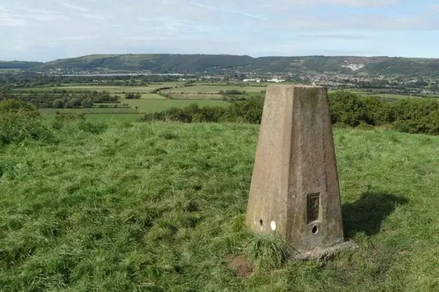
This walk is a short, charming ramble up to the top of Nyland Hill.
From the summit, enjoy lovely views across the surrounding wetlands.
Download the Somerset Walks App to follow this route with real-time GPS navigation.


At a glance
The walk
This is just a short little adventure that takes you to the top of Nyland Hill.
This whole area used to be flooded and this hill used to be an island! Now it's just an interesting little climb to get a great view of the wetlands around you.
Navigate the walks
The easiest way to follow this route is with the Somerset Walks app. Choose the walk and follow the pointer showing your live position on the route map, so you can see you're on the right path.
The app works without a phone signal, so you can keep following the route wherever the walk takes you.

Explore the area
 2.5 miles
 5 miles
 2.25 miles
 3.25 miles
 5 miles
 3 miles
 1.75-3.5 miles
 2.5-3.75 miles
 3.25-6 miles
 2-3.5 miles
 2.5 miles
 2.25-6 miles
 3.25 miles
 3.75 miles
 1.5-9.25 miles
Explore the county
See where the walks start, explore the area and tap a pin to find a route for your next adventure.
Search Somerset walks