
At a glance
Coates Walk
- Distance
- 3.25 miles
- Estimated time
- 1.5 hours
- Route type
- Circular
- GPS app guided
- Yes
- Parking
- Roadside parking at start 51.70646, -2.03247
- Characteristics
- Countryside
Gloucestershire Walks
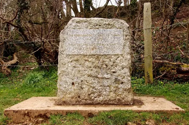
This pleasant circular walk from Coates crosses open countryside and follows a peaceful canal path, passing the historic Coates Portal and Sapperton Tunnel along the way.
There’s an optional detour to the Source of the Thames, where the river famously begins its journey to London, making this a gentle walk that combines rural views with a touch of history.
Download the Gloucestershire Walks App to follow this route with real-time GPS navigation.


At a glance
The walk
This circular walk starts in the lovely village of Coates and takes you across open countryside, towards the source of the Thames.
You will cross the scenic Golden Valley Railway line and pass the Coates Portal and Sapperton Tunnel. This was the longest canal tunnel in England between 1789 to 1811. As you head back along the scenic canal path you will also see the Coates round house.
You may choose to take the detour route which adds a kilometre to the walk, taking you to the source of the Thames. A stone head marks the place in an open field and this is where the Thames starts its journey to London. There is a small amount of road walking along quiet lanes.
Based on 13 user ratings
A very popular walk
Very dog friendly
Generally well maintained
Hard going with a buggy
Not wheelchair accessible
No facilities
Take a packed lunch
Spot on
Real feedback from people who have completed this walk using the Gloucestershire Walks app.
First-hand experiences
There were 2 stiles that many dogs couldn’t get over or through. We have a young, agile dog luckily so she leapt over, but many dogs couldn’t do that.
Very pleasant walk on a cold, frosty morning. Tracks sticky under foot in high foot traffic areas but not too bad. A couple of not dog friendly stiles.
Wholeheartedly recommend this walk. Lots of interesting things to see on route. Really easy to follow using the app.
My kids said it was a fun walk. Likes- the horses. Dislikes- the stinging nettles
Loved the walk, so interesting
Lovely , varied walk with lots of interesting things to see along the way. Treated to Red Kites, Skylarks and Buzzards. Take a drink/snack as nowhere to stop. If you are geocachers, keep walking straight along the public footpath toward the road when you reach the source of the Severn for a cheeky find :-)
Such a shame the pub has shut down
Last part on public footpath was easy walk but the styles at both ends were not easy, especially with a Labrador dog as we had to physically lift her.
Comments from walkers who have completed the Coates walk.
Navigate the walks
The easiest way to follow this route is with the Gloucestershire Walks app. Choose the walk and follow the pointer showing your live position on the route map, so you can see you're on the right path.
The app works without a phone signal, so you can keep following the route wherever the walk takes you.

Explore the area
 2.75 miles
 2.25-4.75 miles
 2.75 miles
 1.5 miles
 2.5 miles
 2.75 miles
 2.25 miles
 0.75 miles
 1-1.5 miles
 3.5 miles
 2.5 miles
 1.75-2.5 miles
 2.25-6.25 miles
 1.75-3.25 miles
 2-4.75 miles
Explore the county
See where the walks start, explore the area and tap a pin to find a route for your next adventure.
Search Gloucestershire walks