
At a glance
Ripley Walk
- Distance
- 5 miles
- Estimated time
- 2.5 hours
- Route type
- Circular
- GPS app guided
- Yes
- Parking
- Market Place Car Park 53.05034, -1.40713
- Characteristics
- Hills, Countryside, Pub
- Ascent
- 150 m
Derbyshire Walks
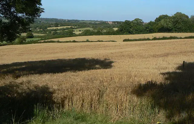
This walk explores the historic market town of Ripley before heading out into the surrounding countryside along part of the ancient Ryknild Street and beside the peaceful Cromford Canal.
This walk offers wide views towards Crich Stand, gentle climbs and a rewarding finish back in town.
Download the Derbyshire Walks App to follow this route with real-time GPS navigation.


At a glance
The walk
This varied walk takes you through part of Ripley an old market town, with a rich industrial heritage. The route takes you along part of Ryknild Street, an old Roman Road and around the lovely countryside surrounding the town, travelling for a short while along the Cromford Canal.
There are some superb views to enjoy and on a clear day you can see Crich stand in the distance. This monument is dedicated to the members of the Worcestershire and Sherwood Forester Regiment who gave their lives in the two World Wars.
Sir Barnes Wallis, famous for his invention of the bouncing bomb used to breach German dams in the war was born in close by Butterley.
There are a couple of gentle climbs and one moderate climb towards the end of the walk but you can reward yourself with refreshments in the town.
Based on 1 user rating
An outstanding walk
Dog heaven
Generally well maintained
Not suitable for pushchairs
Not wheelchair accessible
No facilities
Take a packed lunch
Spot on
Real feedback from people who have completed this walk using the Derbyshire Walks app.
Time for a stop
Navigate the walks
The easiest way to follow this route is with the Derbyshire Walks app. Choose the walk and follow the pointer showing your live position on the route map, so you can see you're on the right path.
The app works without a phone signal, so you can keep following the route wherever the walk takes you.

Explore the area
 1-9 miles
 4.5-8 miles
 5.75 miles
 3.25-5.25 miles
 2-5.25 miles
 3.5-8.5 miles
 1.5-3 miles
 2.75-5.5 miles
 1 miles
 4.5 miles
 1-2.25 miles
 3.5-5.25 miles
 5.25 miles
 3.5 miles
 3.25 miles
Explore the county
See where the walks start, explore the area and tap a pin to find a route for your next adventure.
Search Derbyshire walks