
At a glance
Belper Walk
- Distance
- 5.75 miles
- Estimated time
- 3 hours
- Route type
- Circular
- GPS app guided
- Yes
- Parking
- Belper River Gardens 53.02920, -1.48461
- Characteristics
- Woodland, Countryside, Café, Pub
- Ascent
- 240 m
Derbyshire Walks
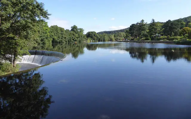
This walk begins in the historic mill town of Belper, once a key centre of the Industrial Revolution.
This walk soon leaves the town behind for open countryside and woodland paths, with lovely views across the Derwent Valley.
Download the Derbyshire Walks App to follow this route with real-time GPS navigation.


At a glance
The walk
Belper became significant early in the Industrial Revolution with the arrival of the textile mills and many of the buildings remain in the town today. This walk leaves the town behind venturing out into open countryside and woods with views of the Derwent Valley.
There is a cafe for refreshments where you park and a nearby pub.
Based on 10 user ratings
An outstanding walk
Fine with dogs
Generally well maintained
Not suitable for pushchairs
Not wheelchair accessible
Very limited facilities
Quite good
Spot on
Real feedback from people who have completed this walk using the Derbyshire Walks app.
First-hand experiences
We went clockwise and quite alot of uphill paths. Really enjoyable walk tho
Beautiful drive to Belper, through the pretty surrounding villages. Belper is a lovely place to explore after the walk too. The walk itself felt mainly uphill, the first 1/2 of it, then short steep decents down. These could be very slippy if very wet. I walked it anticlockwise like another comment said to. Different types of terrain, fields, woodlands, muddy rocky path and pathed. Also a small amount of on road walking. There were a couple of sheep fields to go through and one with cows. They were all over the ‘path’ so i took a detour up and around the field to avoid them.
Lovely interesting walk. There is a fantastic cafe in the river gardens where you park. We walked anti clockwise, which gave lovely views. Only 1 pub at top if Belper Lane End, didn’t go in as we went to the cafe
Beginning of walk is cordoned off until the end of April. Path had collapsed into river.
A great local walk for me. Never done it, so it was a good chance to do a new route.
Comments from walkers who have completed the Belper walk.
Time for a stop
Navigate the walks
The easiest way to follow this route is with the Derbyshire Walks app. Choose the walk and follow the pointer showing your live position on the route map, so you can see you're on the right path.
The app works without a phone signal, so you can keep following the route wherever the walk takes you.

Explore the area
 4.5-8 miles
 2-5.25 miles
 5 miles
 3.25-5.25 miles
 3.5-8.5 miles
 5.25 miles
 2.75-5.5 miles
 1-9 miles
 1 miles
 3.5 miles
 1-2.25 miles
 3.5-4.25 miles
 4.5 miles
 1.25-4 miles
 1.5-2.25 miles
Explore the county
See where the walks start, explore the area and tap a pin to find a route for your next adventure.
Search Derbyshire walks