

Staffordshire Walks

Tittesworth Reservoir Walk and Route Maps

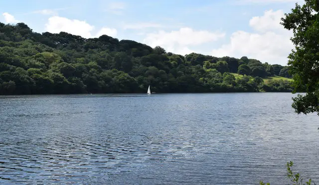
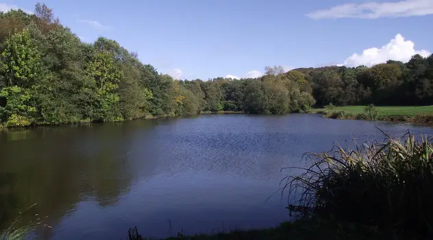
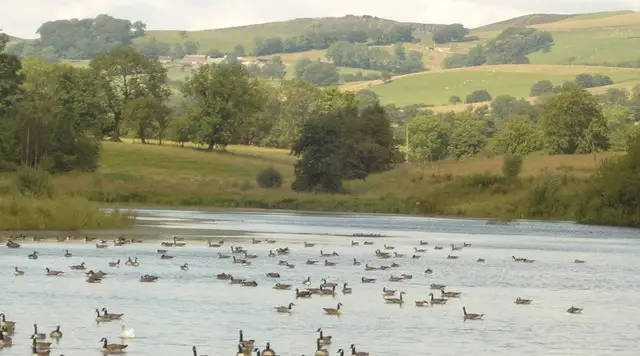
Open water of Tittesworth Reservoir with wooded banks and gentle hills beyond
Tittesworth Reservoir · Photo: Barry Daniels

Tittesworth Reservoir lies close to Leek in the Staffordshire Moorlands, where the River Churnet is held back to form a large expanse of water. It is a working reservoir, owned and run by Severn Trent Water, and its shoreline makes a pleasant setting for a walk with plenty of variety.

The original reservoir was built in 1858 as a compensation reservoir, to regulate the flow of the Churnet for the mills downstream. It was later extended in the twentieth century, growing from about 51 acres to around 190 acres, which is why it looks so substantial today.

Our circular walk takes in the water's edge and the dam, then heads into woodland before returning to the visitor centre and the Waterview Restaurant. The gradients are gentle, and information boards along the way help you spot the birdlife and wildlife. For more walks like this, take a look at the Staffordshire Walks app.

Download the Staffordshire Walks App to follow this route with real-time GPS navigation.

Download on the App Store Get it on Google Play

On a computer? Scan the QR code with your phone's camera to get the Staffordshire Walks app.

Tittesworth Reservoir walk 01

Tittesworth Reservoir Walk

Walk distance
4½ miles
Time
2.5 hours
Route type
Circular

A circuit of Tittesworth Reservoir, the large water storage reservoir fed by the River Churnet near Leek. The reservoir is the main attraction here, and the route keeps returning to its edge, with the dam and the open water as the highlights.

Away from the water the walk spends a good deal of its time among trees, passing through Hawthorne Wood and Hind's Clough Wood, and it goes close to the village of Meerbrook early on. Along the way you will find information boards on the birdlife and wildlife of the reservoir and the River Churnet.

The going is gentle, with only low, easy climbs overall. The walk finishes back by the visitor centre and the Waterview Restaurant, handy for a drink or a bite to eat afterwards. It makes a relaxed morning or afternoon.


Tittesworth Reservoir Walk No ratings yet Be the first - rate this walk in the Staffordshire Walks App

Navigate the walks

Staffordshire Walks App

Follow the Tittesworth Reservoir walk with GPS guidance

It's like sat-nav, but for footpaths.

Choose a walk and follow the pointer showing your live position on the route map, so you always know you're on the right path.

The app works without a phone signal, so you can keep following the route wherever the walk takes you.

Download the app

Download on the App Store Get it on Google Play

On a computer? Scan the QR code with your phone's camera to get the Staffordshire Walks app.

Staffordshire Walks app showing the walker's live position on a route map

Designed to be simple

  • Choose a walk and follow the pointer
  • See your live position on the route map
  • Works without a phone signal
  • Includes 150+ Staffordshire walks
  • Free one-month trial
  • Available for iPhone and Android

Explore the area

Nearby walks

Explore the county

Staffordshire walks map

Map data © OpenStreetMap contributors

Search Staffordshire walks

See where the walks start, explore the area and tap a pin to find a route for your next adventure.

Search Staffordshire walks
Expanded route map for Tittesworth Reservoir Walk, a 4.5 mile circular walk in Staffordshire