

Staffordshire Walks

Merryton Low Walk and Route Map

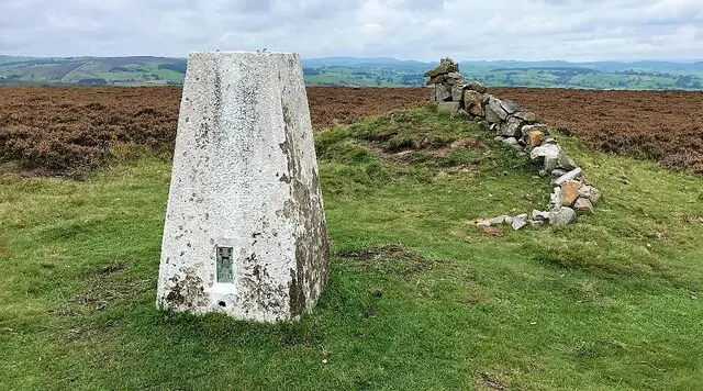
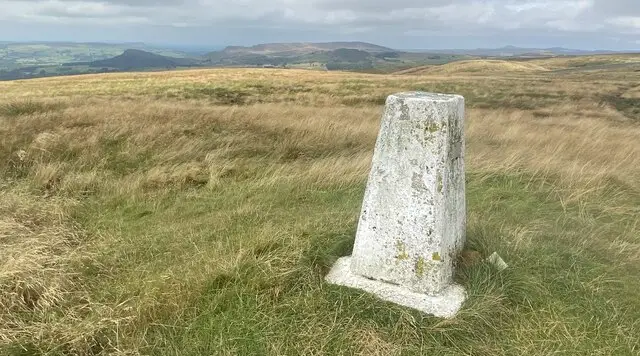
Open moorland on Merryton Low with a trig pillar on the summit and the distant ridge of The Roaches beyond
Merryton Low · Photo: John H Darch

Merryton Low is the highest point of Morridge, a long ridge of high moorland a few miles east of Leek in the Staffordshire part of the Peak District National Park. At around 489 m it is not a hard summit to reach, and this short walk is an easy way to enjoy some of the best open views in the area, across to The Roaches, Ramshaw Rocks and Hen Cloud.

The hill has plenty of history for such a small walk. Its name goes back to a 13th-century spelling, Meriloneslowe, and describes a barrow beside a boundary lane. A Bronze Age bowl barrow still marks the summit, which is also where three parish boundaries meet. The Grade II listed Ordnance Survey trig pillar carries a plaque in memory of four local Home Guard men who died on active service in the Second World War.

Close to the start is Blake Mere, a small, dark pool that has gathered local tales of bottomless water and strange goings-on. For more walks in the county, take a look at the Staffordshire Walks app.

Download the Staffordshire Walks App to follow this route with real-time GPS navigation.

Download on the App Store Get it on Google Play

On a computer? Scan the QR code with your phone's camera to get the Staffordshire Walks app.

Merryton Low walk 01

Merryton Low Short Walk

Walk distance
½ miles
Time
30 mins
Route type
Circular

A very short but rewarding stroll onto Merryton Low, the highest point of the long moorland ridge of Morridge.

It is easy going, with only the gentlest rise, and it makes a quick leg stretch for anyone who wants a big panoramic moorland view without a big effort.

The walk begins close to Blake Mere, a small, dark, peat-stained pool with a good deal of local folklore attached to it. It then heads up to the summit, where you can look for the Grade II listed Ordnance Survey trig pillar.

Its plaque remembers four men of the local Home Guard who died on active service during the Second World War. A bowl barrow from the Bronze Age sits on the hilltop too, so you are walking on very old ground.

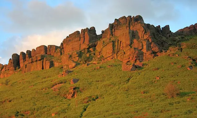
On a clear day the outlook takes in The Roaches, Ramshaw Rocks and Hen Cloud. It is open moorland, so bring a windproof layer, as it can feel exposed up here.

Merryton Low Short Walk No ratings yet Be the first - rate this walk in the Staffordshire Walks App

Navigate the walks

Staffordshire Walks App

Follow the Merryton Low walk with GPS guidance

It's like sat-nav, but for footpaths.

Choose a walk and follow the pointer showing your live position on the route map, so you always know you're on the right path.

The app works without a phone signal, so you can keep following the route wherever the walk takes you.

Download the app

Download on the App Store Get it on Google Play

On a computer? Scan the QR code with your phone's camera to get the Staffordshire Walks app.

Staffordshire Walks app showing the walker's live position on a route map

Designed to be simple

  • Choose a walk and follow the pointer
  • See your live position on the route map
  • Works without a phone signal
  • Includes 150+ Staffordshire walks
  • Free one-month trial
  • Available for iPhone and Android

Explore the area

Nearby walks

Explore the county

Staffordshire walks map

Map data © OpenStreetMap contributors

Search Staffordshire walks

See where the walks start, explore the area and tap a pin to find a route for your next adventure.

Search Staffordshire walks
Expanded route map for Merryton Low Short Walk, a 0.5 mile circular walk in Staffordshire