

Derbyshire Walks

Padley Gorge Walk and Route Maps

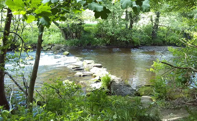
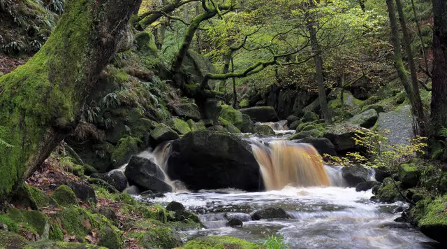
A rocky brook running through ancient woodland in a steep-sided gorge in the Peak District
Padley Gorge · Photo: Andy Stephenson

Padley Gorge is a steep, wooded valley on the Longshaw Estate, within the Peak District National Park in Derbyshire. Burbage Brook runs down through the gorge, and the name Longshaw is thought to come from the long wood that fills it. The estate also takes in moorland and farmland, with traces of Bronze Age and medieval settlement.

The walk on the Derbyshire Walks app is a 2 mile circuit that follows the brook and passes Yarncliff Quarry and Yarncliff Wood, where millstones were cut from the local gritstone as far back as the 15th century. You also cross the Hope Valley railway, climb through Bolehill Wood and pass tree stumps embedded with coins on the way back to the start.

It is a short walk, suited to a morning or afternoon, though the paths are rough in places and there is a steady climb on the return. Grindleford Station Cafe sits just off the route.

Download the Derbyshire Walks App to follow this route with real-time GPS navigation.

Download on the App Store Get it on Google Play

On a computer? Scan the QR code with your phone's camera to get the Derbyshire Walks app.

Padley Gorge walk 01

Padley Gorge Circular Walk

Walk distance
2 miles
Time
1 hour
Route type
Circular

A compact circuit through the woods and rocky stream of Padley Gorge, on the Longshaw Estate in the Peak District. You pass old millstone quarries at Yarncliff, follow Burbage Brook, cross the Hope Valley railway and climb gently through Bolehill Wood. The paths are rough in places, so wear sturdy footwear. It makes an easy outing for a short morning or afternoon, with a station cafe close to the route.

Padley Gorge Circular Walk No ratings yet Be the first - rate this walk in the Derbyshire Walks App

Navigate the walks

Derbyshire Walks App

Follow the Padley Gorge walk with GPS guidance

It's like sat-nav, but for footpaths.

Choose a walk and follow the pointer showing your live position on the route map, so you always know you're on the right path.

The app works without a phone signal, so you can keep following the route wherever the walk takes you.

Download the app

Download on the App Store Get it on Google Play

On a computer? Scan the QR code with your phone's camera to get the Derbyshire Walks app.

Derbyshire Walks app showing the walker's live position on a route map

Designed to be simple

  • Choose a walk and follow the pointer
  • See your live position on the route map
  • Works without a phone signal
  • Includes 250 Derbyshire walks
  • Free one-month trial
  • Available for iPhone and Android

Explore the area

Nearby walks

Explore the county

Derbyshire walks map

Map data © OpenStreetMap contributors

Search Derbyshire walks

See where the walks start, explore the area and tap a pin to find a route for your next adventure.

Search Derbyshire walks
Expanded route map for Padley Gorge Circular Walk, a 2 mile circular walk in Derbyshire