

Derbyshire Walks

Bamford Edge Walk and Route Maps

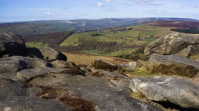
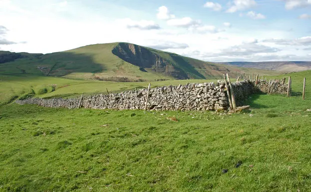
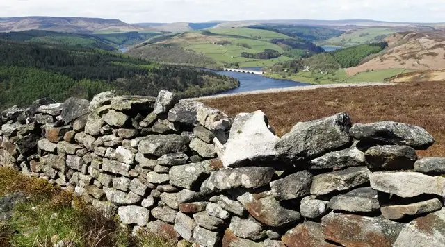
Gritstone outcrops on Bamford Edge with a wide view across the Hope Valley towards Ladybower Reservoir
Bamford Edge · Photo: Neil Theasby

Bamford Edge is a gritstone escarpment on the southern side of the Dark Peak, looking out over the Hope Valley and Ladybower Reservoir. The rock faces south-west and is a well known climbing crag, with around 150 routes. For walkers it makes a rewarding objective, with a steep climb up from the road and wide views as soon as you reach the top.

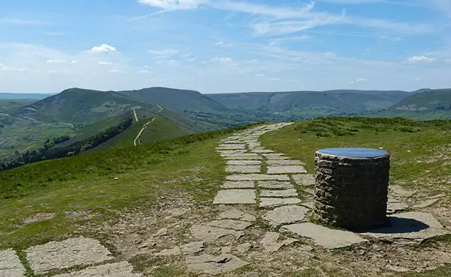
We have three walks here on the Derbyshire Walks app. The shortest is a compact climb to the edge itself. The medium route extends onto the moor and adds the Rivelin Tunnel, a Sheffield waterworks pipeline from the Upper Derwent Valley, along with its stone sighting tower and the viewpoint at Great Tor. The longest also reaches Stanage Edge, so you walk along two of the area's famous edges in a single circuit.

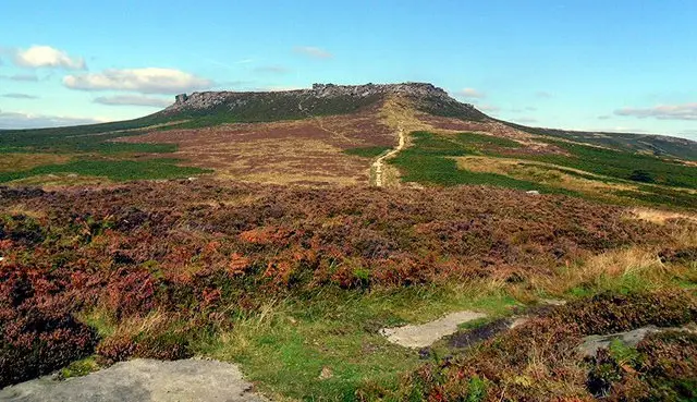
Each route starts with a steep climb, so allow time and wear sturdy footwear. Derwent, Stanage and Bamford edges mark the boundary between the gentler White Peak and the higher Dark Peak moorland, and you can feel that change in the landscape as you gain height. The walks range from 1.4 to 4.9 miles.

Download the Derbyshire Walks App to follow these routes with real-time GPS navigation.

Download on the App Store Get it on Google Play

On a computer? Scan the QR code with your phone's camera to get the Derbyshire Walks app.

Bamford Edge walk 01

Bamford Edge Short Walk

Walk distance
1¼ miles
Time
30 mins
Route type
Circular

A compact walk up to Bamford Edge, the gritstone escarpment above the Hope Valley. The climb is steep at the start, but it is soon over, and the open views towards Ladybower Reservoir make the effort worthwhile. A good choice if you are short on time but want a proper taste of the Peak District edges.

Bamford Edge walk 02

Bamford Edge and Rivelin Tunnel Walk

Walk distance
3¾ miles
Time
2 hours
Route type
Circular

A medium-length circular walk combining open moorland, the Rivelin Tunnel and its stone sighting tower, and the rocky run of Bamford Edge. Great Tor adds a fine viewpoint over the Hope Valley and Ladybower Reservoir. There is a steep climb at the start and a few moderate ones later, so allow a relaxed morning or afternoon.

Bamford Edge walk 03

Bamford Edge and Stanage Edge Walk

Walk distance
5 miles
Time
2.5 hours
Route type
Circular

A satisfying circuit linking two of the Peak District's great gritstone edges. You reach Stanage Edge on the high moor, pass the Rivelin Tunnel and its sighting tower, then finish along Bamford Edge and Great Tor with views over Ladybower Reservoir. Hilly in places, and best saved for a clear day.

These Bamford Edge walks start at grid reference: 53.35245,-1.680592

Navigate the walks

Derbyshire Walks App

Follow the Bamford Edge walks with GPS guidance

It's like sat-nav, but for footpaths.

Choose a walk and follow the pointer showing your live position on the route map, so you always know you're on the right path.

The app works without a phone signal, so you can keep following the route wherever the walk takes you.

Download the app

Download on the App Store Get it on Google Play

On a computer? Scan the QR code with your phone's camera to get the Derbyshire Walks app.

Derbyshire Walks app showing the walker's live position on a route map

Designed to be simple

  • Choose a walk and follow the pointer
  • See your live position on the route map
  • Works without a phone signal
  • Includes 250 Derbyshire walks
  • Free one-month trial
  • Available for iPhone and Android

Explore the area

Nearby walks

Explore the county

Derbyshire walks map

Map data © OpenStreetMap contributors

Search Derbyshire walks

See where the walks start, explore the area and tap a pin to find a route for your next adventure.

Search Derbyshire walks
Expanded route map for Bamford Edge Short Walk, a 1.25 mile circular walk in Derbyshire