
May Hill Walk and Map
May Hill is located on the Gloucestershire and Herefordshire border a promises an energetic walk with wonderful views.
Download the app to see your position on the May Hill map as you walk.


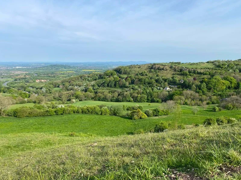
Photo © Jonathan Billinger (cc-by-sa/2.0)
With its scenic landscapes, majestic vistas, diverse wildlife, and rich history, May Hill offers a rewarding journey through the beautiful English countryside where you can enjoy nature all around. So, lace up your walking boots, breathe in the fresh air, and let the enchanting charm of May Hill take you on an energetic adventure.
The starting location for this walk is grid reference: 51.89717,-2.451114
May Hill walk
3.25 miles
This is a lovely walk to the top of May Hill for walkers who like more of a workout, combined with beautiful views with rolling hills, ancient woodlands and picturesque meadows. This walk takes you through both open countryside and covered forestry in Newent Woods.
May Hill is steeped in folklore and history, adding an extra layer of intrigue to your walk. According to local legend, May Hill was once home to fairies, and on May Day, villagers would dance around its summit.
One of the highlights of walking at May Hill is the panoramic view it offers from its summit. As you reach the top, you'll be rewarded with an amazing view that stretches across the surrounding counties. On a clear day, you can marvel at the beauty of the Malvern Hills, the Cotswold Escarpment, and even catch a glimpse of the distant Welsh mountains.
Please note, there are some steeper parts going up to the hill.
Here are a few more Gloucestershire and Cotswold walks on the app.


You can find more Cotswolds and Gloucestershire walks here