

Gloucestershire Walks

10 Best Walks in the Cotswolds with Route Maps

10 Best Walks in the Cotswolds with Route Maps, Gloucestershire

The Cotswolds is home to some of the most picturesque walks in England, offering a perfect blend of natural beauty, historic sites, and charming villages. From the gentle strolls through Bibury’s iconic stone cottages to the hilltop views from Broadway Tower, the region has something for every walker. Whether you're looking for a short village walk or a longer countryside adventure, the Cotswolds provides a stunning setting to explore its landscapes and culture. And don’t forget, the beautiful and cosy Cotswold pubs! Here are the top 10 walks to experience the best of this beautiful area.

With over 150 walks to choose from, download the Gloucestershire and Cotswolds walking app to get these walks and see your position on the route map as you walk.

Download the Gloucestershire Walks App to follow these routes with real-time GPS navigation.

Download on the App Store Get it on Google Play

On a computer? Scan the QR code with your phone's camera to get the Gloucestershire Walks app.

Walk details

Bibury walks

Walk distance
1¾ - 11¾ miles
Time
1 - 6 hours
Route type
Circular

1.75 to 11.75 miles

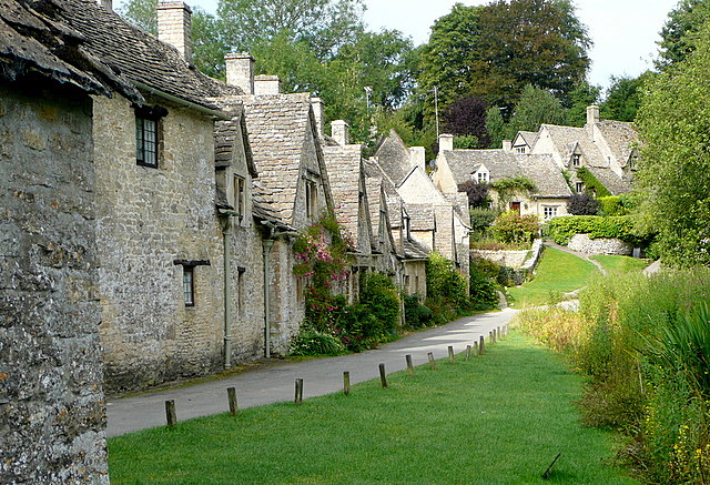
Bibury offers several beautiful circular walks in the Cotswolds, ranging from a 1.75-mile village stroll to an 11.75-mile countryside adventure. Routes pass iconic landmarks like Arlington Row, the River Coln, and nearby villages such as Ablington and Coln St Aldwyns. Scenic views, woodland trails, and charming pubs make these walks perfect for exploring the area's quintessential charm. Whether seeking a short outing or a longer trek, Bibury delivers a classic Cotswold experience.

View a walk route map and more about all 5 Bibury walks here.

Here is an example of a route map you will find on our app. This map is for one of our Bibury walks and shows the location of the pubs.

View the walks and route maps

Walk details

Winchcombe walk

Walk distance
4¾ miles
Time
2.5 hours
Route type
Circular

5.25 miles

This 5.25-mile circular walk around Winchcombe explores the medieval town, including its shops and pubs, and ventures into the Cotswold countryside. Highlights include Sudeley Castle, a Grade 1 listed historic site, and hilltop views. The route involves some climbs and minor road walking but offers a great mix of scenery and history. Perfect for exploring the heart of the Cotswolds.

Find out more and view the walk route map here.

View the walk and route map
Walk distance
4¾ miles
Time
2.5 hours
Route type
Circular

4.75 miles

Bourton-on-the-Water offers a wonderful 4.75-mile circular walk through the charming Cotswolds. This route starts in the village, known for its Cotswold stone cottages and the River Windrush running through it. The walk also passes several pubs, including The Kingsbridge and The Mousetrap Inn. It continues through the countryside and visits neighbouring cotswold villages with additional pub stops. The route includes some road walking but offers ample opportunity to enjoy the area’s beauty and local refreshments.

View the walks and route maps

Walk details

Broadway walk

Walk distance
4 miles
Time
2 hours
Route type
Circular

4 miles

The Broadway Tower walk is a 4-mile route showcasing the charm of the Cotswolds. Starting in Broadway village, it features pretty stone cottages, cafés, and boutique shops before climbing Broadway Hill to the iconic Broadway Tower. This walk rewards you with sweeping views across 12 counties and a chance to explore the historic 18th-century tower. Refreshments are available at the Morris & Brown Café near the summit. The route then circles back to Broadway, offering more beautiful views of the Cotswold countryside.

Find details and a walk route map here.

View the walk and route map

Walk details

Burford walk

Walk distance
6 miles
Time
3 hours
Route type
Circular

6 miles

This 6-mile walk from Burford, the "gateway to the Cotswolds," explores the beautiful Windrush Valley. Starting in the historic town, the route follows the River Windrush to St Oswald’s Church, an isolated medieval gem amidst former village ruins. The route continues across the Cotswold countryside to Fulbrook before looping back to Burford, offering opportunities to explore medieval buildings and enjoy local pubs and cafes. Perfect for experiencing classic Cotswold charm.

Discover more and get the walk route map here.

View the walk and route map
Walk distance
1¾ - 9½ miles
Time
1 - 4.5 hours
Route type
Circular

1.75 to 3 miles

Explore two beautiful walks through the pretty Cotswold villages of Lower and Upper Slaughter. The shorter, 1.75-mile route highlights historic stone houses and the River Eye, while the 3-mile walk extends through idyllic Cotswold countryside. Both routes showcase quintessential Cotswold character, passing a restored mill, tea room, and The Slaughters Country Inn for refreshments. Perfect for immersing yourself in the Cotswolds countryside beauty.

View the walks and route maps

Walk details

Snowshill walk

Walk distance
2 - 3¾ miles
Time
1 - 2 hours
Route type
Circular

2 to 3.75 miles

Snowshill offers two beautiful Cotswold walks starting in the pretty village. The 2-mile route passes Snowshill Manor and explores the beautiful countryside with steep sections offering views across the Severn Valley. The longer 3.75-mile walk incorporates woodland trails and parts of the Cotswold Way. Both routes include visits to Snowshill’s unspoiled village charm and offer refreshments at the wonderful Snowshill Arms pub.

You can get a walk route map and more details here.

View the walks and route maps
Walk distance
2 - 2½ miles
Time
1 - 1.5 hours
Route type
Circular

2.25 to 3 miles

The Painswick Beacon walk is a beautiful 2.25-mile circular route in the Cotswolds. Starting from a wooded car park, it leads to the Iron Age hill fort at the beacon, offering panoramic views of the Cotswold countryside, Malvern Hills, and Forest of Dean. The route features sections of The Cotswold Way and if you would like a slightly longer walks, there is a 3 mile route with a detour through Popes Wood for added woodland charm.

For a walk route map and more info, visit here

View the walks and route maps

Walk details

Sapperton walk

Walk distance
2¼ - 4¾ miles
Time
1 - 2.5 hours
Route type
Circular

3.25 miles

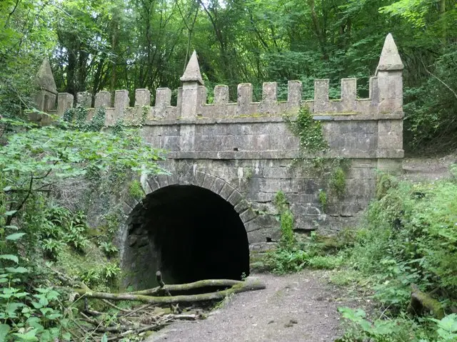
The Sapperton walk is a 3.25-mile circular route starting near St Kenelms Church in the Cotswold village of Sapperton. It leads through countryside, including Gloucestershire Wildlife Trust reserves and along the Thames and Severn Canal. The walk also passes the Sapperton Canal Tunnel and offers visits to two pubs for refreshments. Quiet lanes are also part of the route. It’s perfect for those looking for a mix of nature, history, and local Cotswold charm.

For more information and a route map, visit the Sapperton walk page.

Here are a few more walks you can find on the app.

View the walks and route maps

Navigate the walks

Gloucestershire Walks App

Download the Gloucestershire Walks app

It's like sat-nav, but for footpaths.

Choose a walk and follow the pointer showing your live position on the route map, so you always know you're on the right path.

The app works without a phone signal, so you can keep following the route wherever the walk takes you.

Download the app

Download on the App Store Get it on Google Play

On a computer? Scan the QR code with your phone's camera to get the Gloucestershire Walks app.

Gloucestershire Walks app showing the walker's live position on a route map

Designed to be simple

  • Choose a walk and follow the pointer
  • See your live position on the route map
  • Works without a phone signal
  • Includes 200 Gloucestershire walks
  • Free one-month trial
  • Available for iPhone and Android

Explore the county

Gloucestershire walks map

Map data © OpenStreetMap contributors

Search Gloucestershire walks

See where the walks start, explore the area and tap a pin to find a route for your next adventure.

Search Gloucestershire walks
Expanded route map for Bibury walks