Cleeve Hill Walk
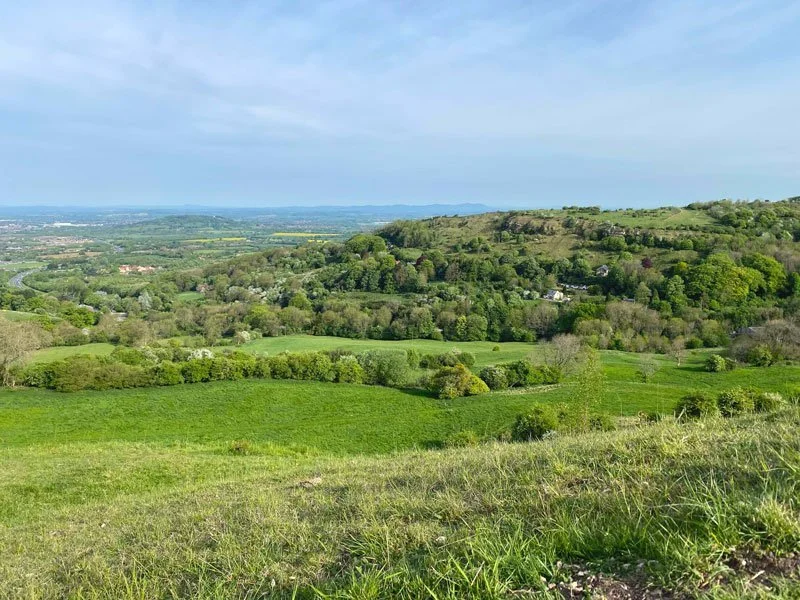
Cleeve Hill is located a few miles from Cheltenham and is the highest point in the Cotswold hills (1080 feet high). If you like walks with amazing views, head over to Cleeve Hill Common where you can see for miles around. We have three Cleeve Hill walks on the app for you to explore.


Download the app to see your position on the Cleeve Hill route maps as you walk.
Here is a map for a Cleeve Hill walk (walk 3 on the app)

© OpenStreetMap contributors
Contains OS data © Crown copyright and database right 2021

Photo © Philip Halling (cc-by-sa/2.0)
The start location for these walks are: Grid reference 51.921905,-2.010152
Cleeve Hill walk 1
2.25 miles
The first walk is the shortest of three walks from Cleeve Hill Common Car Park (where the pylons are). There are a few slopes but this walk is the easiest way to see the beautiful views across Cheltenham, the Malvern Hills and into Wales on a clear day. The walk crosses the open common, taking you past the Memorial Tree, a single Beech tree which is the highest tree in the Cotswolds.
Cleeve Hill walk 2
4.5 miles
The second Cleeve hill walk takes you across the common, providing you with some magnificent views over Cheltenham, Malvern and into Wales. There are some steep sections during the course of this walk.
Cleeve Hill walk 3
6 miles
The third Cleeve Hill walk is the longest and provides some beautiful views over the Cotswold countryside, taking in views over Winchcombe, Cheltenham and the Malvern Hills. The walk follows part of the Cotswold Way, crossing over the limestone grasslands and the diverse habitat of the common, it also takes you across fields and streams where you can hear the flowing waters as well as passing through the Breakheart Plantation woodland which provides some shade on a hot day. There are some steep sections during the course of the walk.