
At a glance
Upper Woodford Walk
- Distance
- 7.5 miles
- Estimated time
- 3.5 hours
- Route type
- Circular
- GPS app guided
- Yes
- Parking
- Limited free parking at start 51.14657, -1.81270
- Characteristics
- Hills
Wiltshire Walks
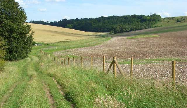
This walk is a demanding but rewarding route around Upper Woodford.
With a challenging ascent to Boreland Hill, a sweeping high-level section, and a gentler return along the Pewsey Avon Trail, this walk combines effort with beautiful scenery, finishing back in the village where the pub offers a welcome rest.
Download the Wiltshire Walks App to follow this route with real-time GPS navigation.


At a glance
The walk
This epic adventure delivers big skies and requires big effort from the outset.
A sustained climb lifts the route onto open downland, where a long, sweeping section brings wide views and an exposed, elemental feel.
At the high point on Boreland Hill, the landscape feels vast before a steep descent drops back towards the village of Upper Woodford where a welcoming pub marks a natural pause after the hills.
The finale follows a gentle stretch of the Pewsey Avon Trail, easing back to the start.
Refreshments:
The Bridge Inn, Upper Woodford
First-hand experiences
Did this walk on a beautiful but very windy day. The only downside to the route was that the section from basically the A303 to the A360 was ankle deep in chalk dust - it got everywhere and the wind didn’t help. Neither did two motorcyclists who went by. I’m not from the area so maybe this is a normal state for tracks to be in!! I liked that stiles had a “lift up” post so that your dog could get through the fence and saw a different view of Stonehenge!
Comments from walkers who have completed the Upper Woodford walk.
Navigate the walks
The easiest way to follow this route is with the Wiltshire Walks app. Choose the walk and follow the pointer showing your live position on the route map, so you can see you're on the right path.
The app works without a phone signal, so you can keep following the route wherever the walk takes you.

Explore the area
 1.5-2.75 miles
 1.25 miles
 3.75-6.75 miles
 1.25 miles
 4.5-6.5 miles
 5-7 miles
 5.5-8.25 miles
 1-7.25 miles
 3.5 miles
 0.5-5.25 miles
 3.25-9.25 miles
 2-8 miles
 2.5-9.5 miles
 5.25-11.75 miles
 2.25-6.5 miles
Explore the county
See where the walks start, explore the area and tap a pin to find a route for your next adventure.
Search Wiltshire walks