Staffordshire Walks

Burnt Wood Walk and Route Map

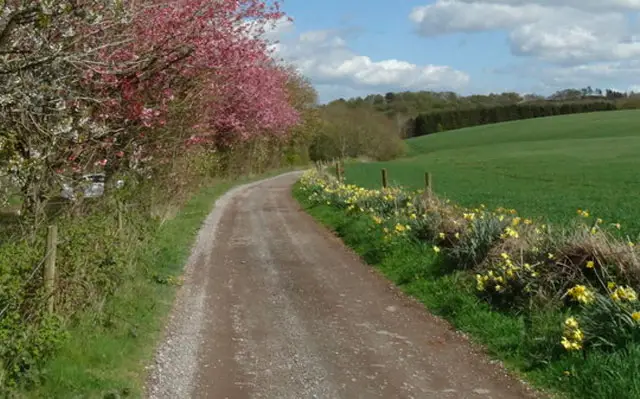
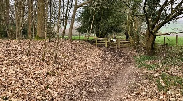
A quiet path at the edge of woodland near Loggerheads in Staffordshire, with fields and trees beyond
Burnt Wood · Photo: Espresso Addict

Loggerheads is a Staffordshire village close to the Shropshire border, with Market Drayton as its postal town. The Burnt Wood walk is a short two-mile circuit from the village, ideal when you want a gentle outing without committing to a long day.

The Loggerheads pub is a short detour from the start making this a nice pub walk. The route also returns through a neat estate where the roads carry bird names, including Woodpecker View, Pheasant Walk, Kestrel Drive and Partridge Ride.

The climbing is gentle throughout, and only a small part of the route runs through woodland.

Neighbouring Mucklestone is well worth knowing about too. It now lies within the parish of Loggerheads and has links with the Battle of Blore Heath. Use the Staffordshire Walks app to follow the route map on the ground, with the start point and parking details to hand.

Download the Staffordshire Walks App to follow these routes with real-time GPS navigation.

Download on the App Store Get it on Google Play

On a computer? Scan the QR code with your phone's camera to get the Staffordshire Walks app.

Burnt Wood walk 01

Burnt Wood Walk, Loggerheads

Walk distance
2 miles
Time
1 hour
Route type
Circular

A compact two-mile loop around Loggerheads in north Staffordshire, taking in mainly the woodland paths of Burnt Woods. The ground is mostly gentle, with only a modest rise along the way, so it suits a short outing at an easy pace. The Loggerheads pub is right by the start, which makes it simple to round things off with refreshments once you are back.

Burnt Wood Walk, Loggerheads No ratings yet Be the first - rate this walk in the Staffordshire Walks App

Burnt Wood walk 02

Burnt Wood Long Walk from Loggerheads

Walk distance
5¾ miles
Time
3 hours
Route type
Circular

A longer circuit from Loggerheads that links three stretches of woodland, Bishops Wood, Park Springs and Burnt Wood, with quiet lanes and the settlements of Hales and Blore in between. The gradients are gentle, so it works well as a relaxed half-day walk on the Staffordshire and Shropshire border, with the village pub close to the start for a drink afterwards.

Burnt Wood Long Walk from Loggerheads No ratings yet Be the first - rate this walk in the Staffordshire Walks App

Navigate the walks

Staffordshire Walks App

Follow the Burnt Wood walks with GPS guidance

It's like sat-nav, but for footpaths.

Choose a walk and follow the pointer showing your live position on the route map, so you always know you're on the right path.

The app works without a phone signal, so you can keep following the route wherever the walk takes you.

Download the app

Download on the App Store Get it on Google Play

On a computer? Scan the QR code with your phone's camera to get the Staffordshire Walks app.

Staffordshire Walks app showing the walker's live position on a route map

Designed to be simple

  • Choose a walk and follow the pointer
  • See your live position on the route map
  • Works without a phone signal
  • Includes 150+ Staffordshire walks
  • Free one-month trial
  • Available for iPhone and Android

Explore the area

Nearby walks

Explore the county

Staffordshire walks map

Map data © OpenStreetMap contributors

Search Staffordshire walks

See where the walks start, explore the area and tap a pin to find a route for your next adventure.

Search Staffordshire walks
Expanded route map for Burnt Wood Walk, Loggerheads, a 2 mile circular walk in Staffordshire