

Derbyshire Walks

Monsal Head Walk and Route Map

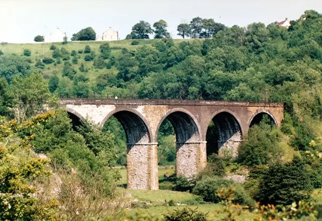
View from Monsal Head over the green valley of Monsal Dale, with the River Wye winding below and a railway viaduct crossing the dale
Monsal Head · Photo: Graham Hogg

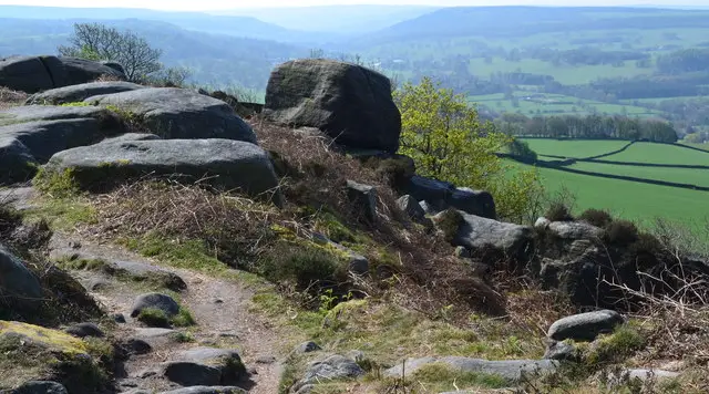
Monsal Head is a hamlet on the edge of Monsal Dale in the Peak District, best known for the view from its viewpoint. From here, the River Wye winds through the green valley below and Headstone Viaduct crosses the dale. The three circular walks on this page all begin at the same spot, with the Monsal Head Hotel and a café close to the start.

The shortest walk is 1.5 miles and stays close to the viaduct, the old railway line and the Wye. The middle route is 3.6 miles and spends longer in the valley, passing the Monsal Trail, Brushfield Lane and the woods at New Plantation and Fin Wood.

The longest walk is 6.2 miles and reaches further along the Wye. It uses the Monsal Trail through Cressbrook Tunnel, passes close to Cressbrook, Water-cum-Jolly Dale and Litton Mill, and runs beside Priestcliffe Lees Nature Reserve, before returning through Brushfield and down to the river.

Monsal Dale is a Site of Special Scientific Interest, and the railway that once crossed it, built by the Midland Railway in 1863, is now the Monsal Trail. Each walk has a route map in the Local Walks app, so you can enjoy the scenery and the history and let the app do the navigating.

Download the Derbyshire Walks App to follow these routes with real-time GPS navigation.

Download on the App Store Get it on Google Play

On a computer? Scan the QR code with your phone's camera to get the Derbyshire Walks app.

Monsal Head walk 01

Monsal Head Short Walk

Walk distance
1½ miles
Time
30 mins
Route type
Circular

A short walk that gives you the best of Monsal Dale without a long outing. It begins at a popular viewpoint, where the valley opens out below and Headstone Viaduct crosses the dale.

The route passes the viaduct and the old Midland Railway line, now the Monsal Trail, then drops to the River Wye and runs through woodland at New Plantation and Fin Wood. A steady climb brings you back up to Monsal Head.

The Monsal Head Hotel and a café are close to the start and finish, so refreshments are easy to fit in.

Monsal Head walk 02

Monsal Head Circular Walk

Walk distance
3½ miles
Time
2 hours
Route type
Circular

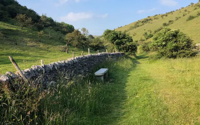
A medium-length walk that spends more time down in the valley. It starts at the Monsal Head viewpoint, with the viaduct and the green sweep of the dale below, before heading out towards Castlegate Lane, Brushfield Lane and the line of the old railway that is now the Monsal Trail.

You then descend to the River Wye and follow the valley through New Plantation and Fin Wood, where the woods and water make for quiet, shaded walking.

There are two steady climbs, one early on and one on the way back up to Monsal Head, where you finish close to Headstone Tunnel and the village refreshments.

Monsal Head walk 03

Monsal Head, Cressbrook and Litton Walk

Walk distance
6¼ miles
Time
3 hours
Route type
Circular

The longest of the Monsal Head walks, and one to take at an easy pace over a morning or afternoon. After the viewpoint and the viaduct, the route follows the Monsal Trail through Cressbrook Tunnel, with Water-cum-Jolly Dale and the village of Cressbrook close by. Nearer Litton Mill, the Priestcliffe Lees Nature Reserve, a steep limestone hillside known for its wild flowers, lies right beside the route.

There are several climbs, including one steep pull up above the Wye. Later the walk returns via Brushfield, then drops to the River Wye and the woods at New Plantation and Fin Wood, before a steady climb back to Monsal Head.

The hotel and café at the start make a welcome finish.

These Monsal Head walks start at grid reference: 53.240115,-1.724682

Navigate the walks

Derbyshire Walks App

Follow the Monsal Head walks with GPS guidance

It's like sat-nav, but for footpaths.

Choose a walk and follow the pointer showing your live position on the route map, so you always know you're on the right path.

The app works without a phone signal, so you can keep following the route wherever the walk takes you.

Download the app

Download on the App Store Get it on Google Play

On a computer? Scan the QR code with your phone's camera to get the Derbyshire Walks app.

Derbyshire Walks app showing the walker's live position on a route map

Designed to be simple

  • Choose a walk and follow the pointer
  • See your live position on the route map
  • Works without a phone signal
  • Includes 250 Derbyshire walks
  • Free one-month trial
  • Available for iPhone and Android

Explore the area

Nearby walks

Explore the county

Derbyshire walks map

Map data © OpenStreetMap contributors

Search Derbyshire walks

See where the walks start, explore the area and tap a pin to find a route for your next adventure.

Search Derbyshire walks
Expanded route map for Monsal Head Short Walk, a 1.5 mile circular walk in Derbyshire