
At a glance
Stonesfield Walk
- Distance
- 5.5 miles
- Estimated time
- 2.5 hours
- Route type
- Circular
- GPS app guided
- Yes
- Parking
- Public library car park 51.85540, -1.42800
- Characteristics
- Woodland, Water, Countryside
Oxfordshire Walks
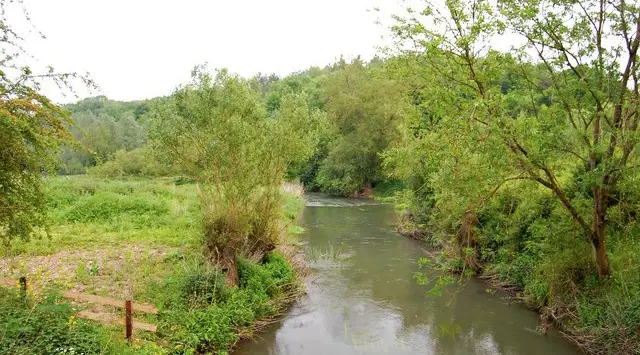
This walk starts in the village of Stonesfield and heads south through peaceful Oxfordshire countryside towards the River Evenlode.
Along the way, it also passes through woodland and the remains of a Roman villa, offering a nice mix of nature and history.
Download the Oxfordshire Walks App to follow this route with real-time GPS navigation.


At a glance
The walk
This pretty walk starts in the village of Stonesfield and takes you south for some lovely walking alongside the River Evenlode before visiting some woodland and the remains of a Roman Villa.
There is a community pub in Stonesfield - The White Horse, but please call them to check that it's open.
Based on 4 user ratings
Mixed feedback from walkers
Limited for dogs
Generally well maintained
Not suitable for pushchairs
Not wheelchair accessible
Very limited facilities
Quite good
Accurate
Real feedback from people who have completed this walk using the Oxfordshire Walks app.
First-hand experiences
This was a great walk. The paths were really clear and the route straightforward to follow. It looks like it may be muddy in places over winter months, but we did this in the summer so can’t comment for sure. Loved how quiet much of it was and a couple of short upward pulls got the heart rate going. Lovely countryside and a charming village to park in. Will do this again.
It was lovely but deserted for much of the route and as a lone female walker I felt a bit too isolated.
Comments from walkers who have completed the Stonesfield walk.
Navigate the walks
The easiest way to follow this route is with the Oxfordshire Walks app. Choose the walk and follow the pointer showing your live position on the route map, so you can see you're on the right path.
The app works without a phone signal, so you can keep following the route wherever the walk takes you.

Explore the area
 2-9.75 miles
 1-4.75 miles
 2.5-7.5 miles
 3.75-6.75 miles
 3.5-10.5 miles
 6-6.5 miles
 2.5-4.75 miles
 2.5 miles
 1.5-4.25 miles
 2.25-4.25 miles
 4.25 miles
 2.5-8.25 miles
 3.5 miles
 5 miles
 0.5-6.75 miles
Explore the county
See where the walks start, explore the area and tap a pin to find a route for your next adventure.
Search Oxfordshire walks