

Gloucestershire Walks

Chipping Campden Walks and Route Maps

Honey-coloured Cotswold stone buildings along the High Street in Chipping Campden, with the arched Market Hall in the foreground
Chipping Campden · Photo: Michael Dibb

Chipping Campden is one of the best-preserved market towns in the Cotswolds. It was planned in the late 12th century, and its wealth came from the wool trade, with merchants travelling from as far as Italy to buy the fleeces. That history is still easy to read in the single, gently curving High Street, lined with honey-coloured limestone buildings. The Jacobean Market Hall, built in 1627 by Sir Baptist Hicks, stands at the centre, and the town is also the northern end of the Cotswold Way.

The three walks here all start on the High Street and quickly leave the buildings for the valley of the Cam. Two shorter circuits follow the stream past Haydon Mill, the ruined Lady Juliana's Gateway and the grassy earthworks of the old Campden House gardens. One of them continues to the neighbouring village of Broad Campden, with its church, Quaker Meeting House and pub, before returning to town.

The longest route is a linear walk that ends in Broad Campden. It takes in more open countryside and one steady climb onto higher ground, with wider views over the farmland. Between them the walks suit a short stroll, a relaxed morning or afternoon, or a good half day, and the town's cafes, tea rooms and pubs are right on the doorstep before and after.

Download the Gloucestershire Walks App to follow these routes with real-time GPS navigation.

Download on the App Store Get it on Google Play

On a computer? Scan the QR code with your phone's camera to get the Gloucestershire Walks app.

Chipping Campden walk 01

Chipping Campden Short Walk

Walk distance
2¼ miles
Time
1 hour
Route type
Circular

A short, gentle circuit that starts among the honey-coloured stone of Chipping Campden's High Street, close to the 1627 Market Hall.

It soon leaves the town behind and follows the little River Cam for much of the way, so there is water alongside for a good part of the walk.

Along the way you pass Haydon Mill, the ruined Lady Juliana's Gateway and the grassy earthworks of the old Campden House gardens, then Berrington Mill.

The route also meets the long-distance Monarch's Way. The going is mostly easy and the climbing is slight, and the walk finishes back along Lower High Street, where cafes and restaurants are close at hand.
Chipping Campden Short Walk View and rate this walk in the Gloucestershire Walks App

Chipping Campden walk 02

Chipping Campden and Broad Campden Walk

Walk distance
2¾ miles
Time
1.5 hours
Route type
Circular

This slightly longer circuit begins on the High Street beside Chipping Campden's Jacobean Market Hall, then follows the Cam out of town past Haydon Mill, Lady Juliana's Gateway and the earthworks of the former Campden House gardens. The stream keeps you company for a good part of the outward leg.

The turning point is Broad Campden, a quieter village with the church of St Michael and All Angels, a Quaker Meeting House and the Bakers Arms. The way back follows George Lane to the edge of Chipping Campden. Climbing is gentle throughout, and it makes an easy morning or afternoon with a village pub as a halfway stop.

Chipping Campden and Broad Campden Walk 5.0 Ratings and reviews 1 rating

Based on 1 user rating

Community feedback

Overall rating5.0

An outstanding walk

Dog friendly5.0 / 5
Path condition5.0 / 5
Buggy friendly1.0 / 5
Wheelchair friendly1.0 / 5
Toilet facilities1.0 / 5
Pub or café3.0 / 5
Route accuracy5.0 / 5
ClimbingGentle slopes
LivestockSome livestock
StilesA stile or two
Mud levelMay be muddy after wet weather

Real feedback from people who have completed this walk using the Gloucestershire Walks app.

Chipping Campden walk 03

Chipping Campden to Broad Campden Linear Walk

Walk distance
5¾ miles
Time
3 hours
Route type
Circular

The longest option starts in the centre of Chipping Campden, the old wool town whose Market Hall dates from 1627, and ends in the village of Broad Campden. The first stretch follows the Cam past Haydon Mill, Lady Juliana's Gateway and the old Campden House earthworks, before the route crosses the Monarch's Way and heads out into more open Cotswold countryside.

The main effort is a steady climb onto higher ground in the second half, which brings wider views over the surrounding farmland. The route passes the church of St Michael and All Angels and the Bakers Arms in Broad Campden, and it finishes in the village, close to the Quaker Meeting House. Allow a good half day.

Chipping Campden to Broad Campden Linear Walk View and rate this walk in the Gloucestershire Walks App

Navigate the walks

Gloucestershire Walks App

Follow the Chipping Campden walks with GPS guidance

It's like sat-nav, but for footpaths.

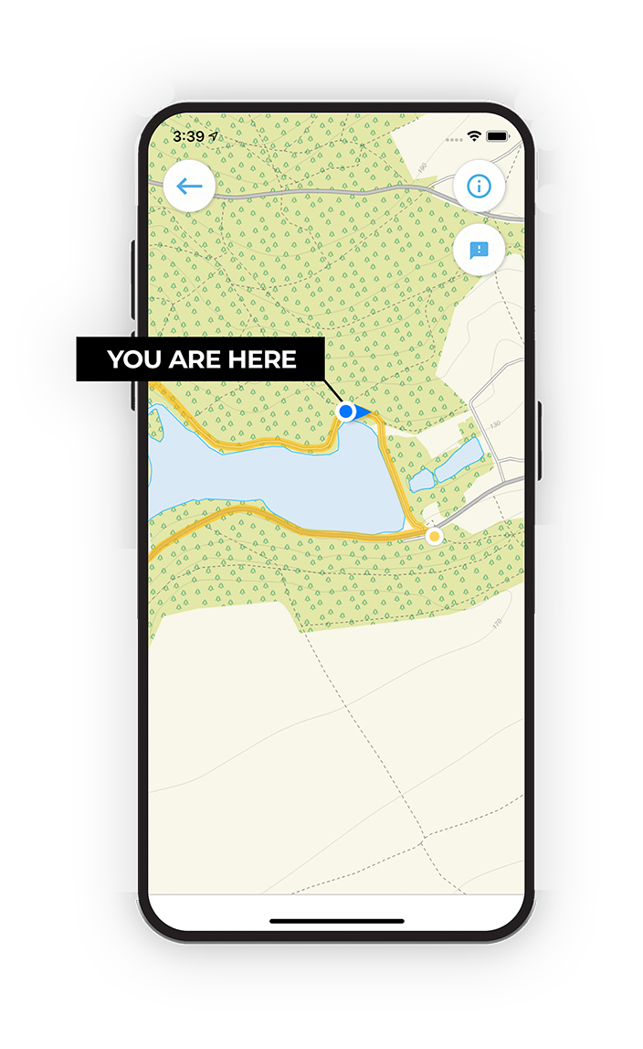
Choose a walk and follow the pointer showing your live position on the route map, so you always know you're on the right path.

The app works without a phone signal, so you can keep following the route wherever the walk takes you.

Download the app

Download on the App Store Get it on Google Play

On a computer? Scan the QR code with your phone's camera to get the Gloucestershire Walks app.

Gloucestershire Walks app showing the walker's live position on a route map

Designed to be simple

  • Choose a walk and follow the pointer
  • See your live position on the route map
  • Works without a phone signal
  • Includes 200 Gloucestershire walks
  • Free one-month trial
  • Available for iPhone and Android

Explore the area

Nearby walks

Explore the county

Gloucestershire walks map

Map data © OpenStreetMap contributors

Search Gloucestershire walks

See where the walks start, explore the area and tap a pin to find a route for your next adventure.

Search Gloucestershire walks
Expanded route map for Chipping Campden Short Walk, a 2.25 mile circular walk in Gloucestershire