

Derbyshire Walks

Staunton Harold Reservoir Walks and Route Maps

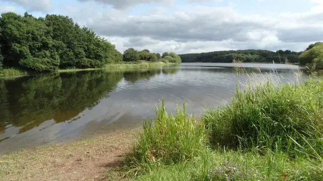
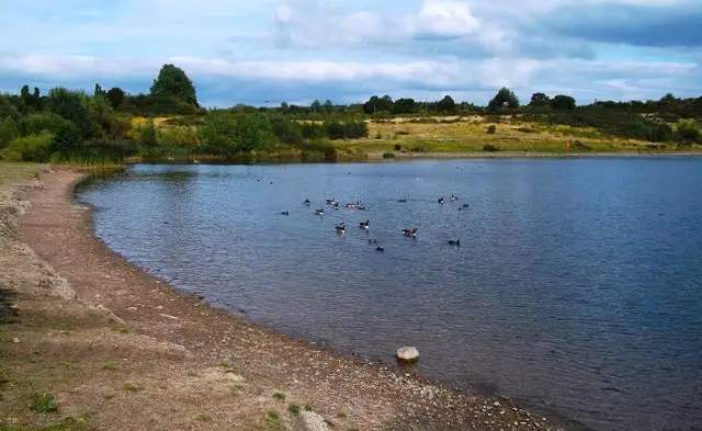
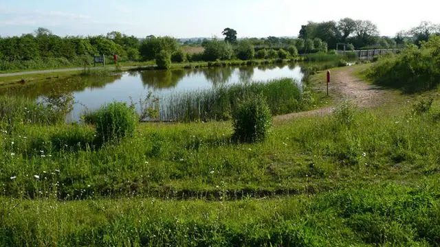
A wide stretch of reservoir water edged by grass and trees under an open sky, with a walking track running alongside the shore.
Staunton Harold Reservoir · Photo: Mat Fascione

Staunton Harold Reservoir sits in the heart of the National Forest, on the border between Derbyshire and Leicestershire. Created in 1964 to supply drinking water to Leicester and the East Midlands, the 210-acre reservoir was developed from one of the six ponds on the neighbouring Calke Abbey estate. Today the National Trust runs the visitor site, while Severn Trent continues to manage the reservoir itself.

We have three walks here on the Derbyshire Walks app. The shortest is an easy there-and-back stroll along the main track beside the water, planned to suit wheels. The second keeps the same starting point but adds a loop into the surrounding countryside, making a short circular outing with a little woodland and some gentle climbs.

The third is the big adventure for those with time and energy. It follows the reservoir to its far end, passes the Calke Abbey information board and the hamlet of Calke, and explores the old mining valley of Dimminsdale and Spring Wood. It then returns through open countryside past The Coppice and Melbourne Pool. Distances range from 1.4 to 7 miles.

Download the Derbyshire Walks App to follow these routes with real-time GPS navigation.

Download on the App Store Get it on Google Play

On a computer? Scan the QR code with your phone's camera to get the Derbyshire Walks app.

Staunton Harold Reservoir walk 01

Staunton Harold Reservoir Short Walk

Walk distance
1½ miles
Time
30 mins
Route type
Circular

An easy there-and-back stroll along the main track beside Staunton Harold Reservoir, set among the National Forest on the Derbyshire and Leicestershire border. The ground is almost flat and the walk was planned to suit wheels, so it works well for families with pushchairs, wheelchair users or anyone who simply wants a relaxed hour by the water.

Staunton Harold Reservoir Short Walk No ratings yet Be the first - rate this walk in the Derbyshire Walks App

Staunton Harold Reservoir walk 02

Staunton Harold Reservoir Circular Walk

Walk distance
1¾ miles
Time
1 hour
Route type
Circular

A compact circuit that begins by the reservoir and then wanders out through the neighbouring countryside, using quiet lanes, a permissive path through Broadstone Holt and field footpaths before returning to the water. It is a good choice if you want a little more variety than the lakeside track, without committing to a long day out.

Staunton Harold Reservoir Circular Walk No ratings yet Be the first - rate this walk in the Derbyshire Walks App

Staunton Harold Reservoir walk 03

Staunton Harold Reservoir and Dimminsdale Long Walk

Walk distance
7 miles
Time
3.5 hours
Route type
Circular

A 7 mile adventure that follows Staunton Harold Reservoir to its far end, passes Calke Abbey's information board and the hamlet of Calke, and explores the old mining valley of Dimminsdale and Spring Wood. The return crosses open countryside past The Coppice and Melbourne Pool. Expect some uneven ground and a few moderate climbs along the way.

Staunton Harold Reservoir and Dimminsdale Long Walk No ratings yet Be the first - rate this walk in the Derbyshire Walks App

Navigate the walks

Derbyshire Walks App

Follow the Staunton Harold Reservoir walks with GPS guidance

It's like sat-nav, but for footpaths.

Choose a walk and follow the pointer showing your live position on the route map, so you always know you're on the right path.

The app works without a phone signal, so you can keep following the route wherever the walk takes you.

Download the app

Download on the App Store Get it on Google Play

On a computer? Scan the QR code with your phone's camera to get the Derbyshire Walks app.

Derbyshire Walks app showing the walker's live position on a route map

Designed to be simple

  • Choose a walk and follow the pointer
  • See your live position on the route map
  • Works without a phone signal
  • Includes 250 Derbyshire walks
  • Free one-month trial
  • Available for iPhone and Android

Explore the area

Nearby walks

Explore the county

Derbyshire walks map

Map data © OpenStreetMap contributors

Search Derbyshire walks

See where the walks start, explore the area and tap a pin to find a route for your next adventure.

Search Derbyshire walks
Expanded route map for Staunton Harold Reservoir Short Walk, a 1.5 mile circular walk in Derbyshire