
Worthing Walks


Download the app with 300 Sussex Walks
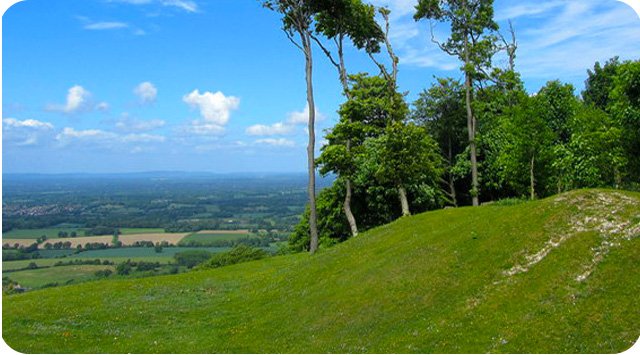
Photo © Chris Heaton (cc-by-sa/2.0)
Worthing walks
Worthing is a coastal town in West Sussex and because it’s close to the South Downs National Park, there are lots of wonderful walks nearby. So, if you fancy a strenuous hike, a woodland walk or a seaside stroll, here are 7 great walking areas near Worthing waiting to be explored on the Sussex Walks app.
Bramber walks
2 miles to 6.75 miles
This first route is a lovely short family friendly pub walk form the pretty village of Bramber, which is seven miles from Worthing. Heading clockwise, the walk first takes you on a short stroll around the remains of the Norman Bramber Castle (there is a small charge for the car park for non members). It then takes you out through countryside for a while before meeting the pretty River Adur for a lovely riverside amble that eventually gets you back to the village where you can walk down the pretty high street and find some pub options for refreshments.
The second route is an extension to the first route that doesn't take you through the Bramber high street for the pub (although you can easily stroll in if you wish). Instead, it extends the loop to make a longer walk that enjoys a lot more walking alongside the lovely River Adur.
The final route is a longer and more strenuous walk that still enjoys the castle remains and lovely riverside walking, but it then also heads off on an adventure along the South Downs Way for a climb up Annington Hill. You'll need more time and energy on this route, but you'll then also be rewarded with some lovely views. There is a short section of roadside walking on the route, so please be careful here.
Chantry Hill walks
1.75 miles to 8 miles
This is a lovely short family-friendly walking loop around the top of Chantry hill, north of Worthing. The car park is already at the top of the hill, so you can enjoy this walk's wonderful views without having to climb too much.
This second route is not much longer than the first route in distance, but it is a lot more energetic as it takes you on a loop down to the bottom of Chantry Hill and then back up Sullington Hill. Make sure you go prepared for a work out on this one.
This third route is basically a nice long open countryside walk around the undulating downs south of Chantry Hill. There is some climbing throughout the walk, but it's not too steep at any point. You could also link this to the first route to make a pleasant figure of 8 route with fabulous views, lots of fresh air, but not too much climbing.
This final route is the 'extreme' version of this walk and it basically takes you on the same long walk around the undulating downs, but then it also takes you on the steep and energetic ascent and descent of Chantry Hill and Sullington hill itself. Expect an epic adventure with fabulous views on this walk.
Cissbury Ring walks
2.5 miles to 9.25 miles
If you live in Worthing, you have probably heard of Cissbury Ring and the Iron Age hill fort but have you ever explored more of the surrounding countryside? We have 4 Cissbury Ring walks on the Sussex Walks app including hills, woodland and amazing views.
Arundel walks
0.75 miles to 8 miles
To the west of Worthing is Arundel and we have 3 lovely walks on the Sussex Walks app for you to enjoy. If you are looking for a wander around the historic town and past the castle, along the River Arun or exploring the surrounding countryside, these Arundel walks should have something for everyone. You can see a walk route map here.
Chanctonbury Ring walks
2.5 miles to 8.75 miles
Chanctonbury Ring is a prehistoric fort located at the top of Chanctonbury Hill, West Sussex. We have 4 Chanctonbury Ring walks and route maps on the Sussex Walks app ranging from 2.5 miles to 8.75 miles. For a Chanctonbury Ring walk map, click here.
Wepham walks
2.75 miles to 6.5 miles
This first route is a nice and simple woodland walk around the pretty Wepham Woods near Worthing. This option is quite a flat walk and doesn't involve the more strenuous hill climbing of the other two routes from this start point.
The second alternative route is known as the South Downs Hare Walk and it heads in a different direction to the first route whilst offering some great views across rolling hills and lots of wildlife. There is a quite steep hill to climb and descend on this route though, so go prepared with some energy!
This third option is a much longer and much more strenuous walk around this beautiful hilly area of the South Downs National Park. It enjoys the walk around Warningcamp Hill like in the second route, but it also visits the village of Wepham before taking you further out into the downs for a walk along Perry Hill and the Windy Ridge. It also takes you on a long woodland track through the Oaken Copse and Wepham Woods and this all makes this an enjoyable and varied walk. You can expect lots of wonderful views and fresh air on this route, but there is also a lot of hill climbing and no refreshments on route, so please go prepared.
West Beach walk
2.25 miles and 4 miles
There are many nice beaches near Worthing and this is a nice and simple short family-friendly stroll around the West Beach Local Nature Reserve. The reserve contains sand flats, shingle, sand dunes and the plants, birds, molluscs, reptiles and mammals which either live or feed on them.
This second route option is basically an extension of the first route if you have a bit more time that you would like to spend walking on the splendid beach here. It enjoys the West Beach Local Nature Reserve as in the first route, but it also walks much further along the beach until it reaches the pebbled 'Climbers Beach' with it's cafe.
There are a lot more walks near Worthing on the Sussex Walks app. The get the app, search ‘Sussex Walks’ on your app store or download the iPhone version here and Android version here.
Bramber walk map (walk 1). Get the app to see your position as you walk.

© OpenStreetMap contributors
Contains OS data © Crown copyright and database right 2021