
Jack and Jill Windmills Walk and Map
The Jack and Jill Windmills are also know as The Clayton Windmills and they both stand proud and tall on the South Downs, close to Brighton. The windmills were originally built in 1765 and Jill Windmill has been fully restored and is still working today. Our walks for the Jack and Jill Windmills will offer great views, wonderful fresh air and energetic hill climbs. We have a few routes on the Sussex Walks app for you to explore and a map for one of the walks is shown below.


Download the app with 300 Sussex Walks and see your position on the map as you walk.
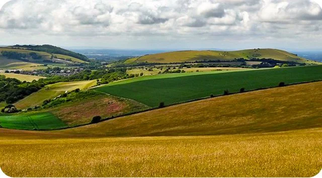
Photo © Ian Cunliffe (cc-by-sa/2.0)
Jack and Jill Windmills
Our first walk for the Jack and Jill Windmills is a relatively easy and short 1.5 mile circular route. The walk takes you to the pair of windmills and then back along the South Downs Way where you can enjoy the lovely views of the Sussex countryside.
For something a bit more energetic, our second route is a longer version of walk 1 which also includes the Jack and Jill Windmills but more of the wonderful South Downs. This walk is 3 miles long and also joins the Sussex Border path for a while.
Our last walk from the Jack and Jill windmills heads further east along the South Downs Way and takes you past Ditchling Down beacon. As with the previous walks, you can expect lots of glorious panoramic views and you will need plenty of energy for this one. As this is a longer walk of 5.75 miles with hills and quite a lot of climbing, please go prepared.
Here is a route map for Jack and Jill Windmills walk 1.
Get the Sussex Walks app to see your position on the map as you walk.

© OpenStreetMap contributors
Contains OS data © Crown copyright and database right 2021
To get the Jack and Jill Windmills walk on your phone, just search ‘Sussex Walks’ on your app store.