
Cissbury Ring Walk and Map
Cissbury Ring is the largest hill fort in Sussex covering over 200 acres and is located near Worthing. It’s owned by the National Trust and is famous for its Neolithic flint mine and Iron Age hill fort, which is one of the largest in Europe. It’s a popular area for walking and offers spectacular views over the South Downs. There are 4 Cissbury Ring routes on the Sussex Walks app and a map for one of the walks is shown below.


Download the app with 300 Sussex Walks and see your position on the map as you walk.
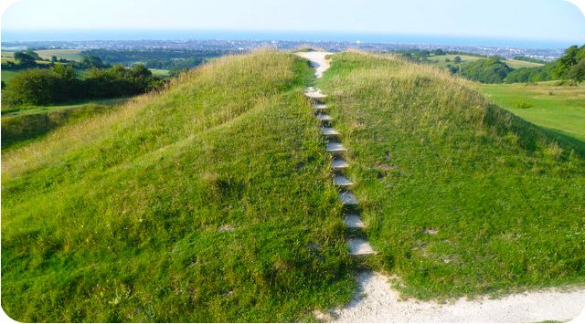
Photo © Marathon (cc-by-sa/2.0)
Cissbury Ring walk
Our shortest Cissbury Ring walk is 2.5 miles long and takes you on a wander around the historic Iron Age hill fort where you can enjoy the history and lovely views.
If you are looking for a longer, more energetic walk, then the second route is a 4.25 hike which includes the Cissbury Ring fort but also explores more of the surrounding South Downs hills and countryside.
Walk number three is an extended version of the first two walks and includes more hills, some woodland, more great views and a trek across Tennants hill. You will need plenty of energy for this route.
The final Cissbury Ring walk is a full on 9.25 mile adventure that includes everything from the previous walks but also heads north across the South Downs countryside to join part the Monarch's Way. As this is a long and strenuous route, please take plenty of food and water and the appropriate equipment.
Here is a map for Cissbury Ring walk 2
Get the Sussex Walks app to see your position as you walk.

© OpenStreetMap contributors
Contains OS data © Crown copyright and database right 2021
There are over 250 Sussex walks on the app, just search ‘Sussex Walks’ on your app store to download the app.