

Derbyshire Walks

Lud's Church Walk and Route Map

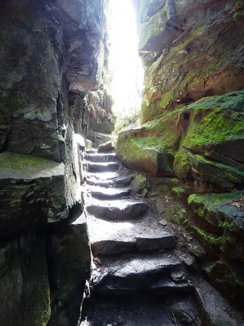
Steps out of Lud's Church
Photo: Neil Theasby

If you’re looking for the best walks to Lud’s Church, these two circular routes explore this fascinating part of the Peak District National Park and some of the beautiful countryside surrounding it.

Hidden within woodland, Lud’s Church is a deep rocky chasm with towering, moss-covered walls that create an atmospheric and almost otherworldly place to explore.

Both of our routes visit Lud’s Church but offer very different adventures. The first approaches via the River Dane and Back Forest Ridge, while the second combines Lud’s Church with a spectacular walk across The Roaches.

Download the Derbyshire Walks App to follow these routes with real-time GPS navigation.

Download on the App Store Get it on Google Play

On a computer? Scan the QR code with your phone's camera to get the Derbyshire Walks app.

Walk distance
4¾ miles
Time
2.5 hours
Route type
Circular

This first circular route takes you through a lovely mixture of riverside paths, woodland and open countryside before climbing up onto Back Forest Ridge and visiting Lud’s Church.

If you tackle the walk clockwise, the first section follows tracks alongside the River Dane before continuing through woodland and pretty open countryside. The route then heads up and over Back Forest Ridge, where you can explore Lud’s Church and see the unusual Hanging Stone rock formation.

This is a strenuous walk with plenty of climbing, but your efforts are rewarded with some impressive views across the Staffordshire countryside. You’ll also have certainly worked up a healthy appetite for a well-deserved visit to the pub at the end of the walk.

View the walk and route map
Walk distance
6¾ miles
Time
3.5 hours
Route type
Circular

This second route is an epic adventure for those who really want to explore this fascinating part of the Peak District National Park.

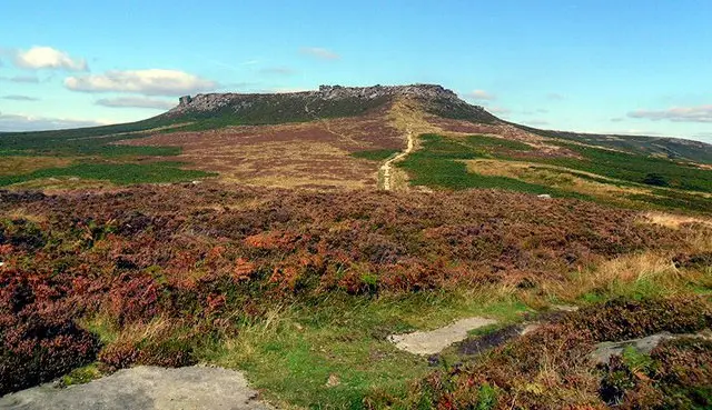
The walk climbs up onto The Roaches before following the dramatic gritstone ridge, where you can enjoy wonderful views across the surrounding countryside. After a gentler section along quiet country lanes, an additional loop takes you into Forest Wood and through Lud’s Church, with its narrow rocky corridor and deep green, moss-covered walls.

This is a long and strenuous walk with plenty of climbing, so make sure you go prepared. There are also sheer drops around parts of The Roaches, and phone GPS accuracy can vary, so take particular care near exposed sections and remain aware of your surroundings.

**Note:** If you would like a little more detail while completing the initial climb onto The Roaches, you can follow the Roaches Walk 1 route map until you reach the top.

View the walk and route map

Navigate the walks

Derbyshire Walks App

Download the Derbyshire Walks app

It's like sat-nav, but for footpaths.

Choose a walk and follow the pointer showing your live position on the route map, so you always know you're on the right path.

The app works without a phone signal, so you can keep following the route wherever the walk takes you.

Download the app

Download on the App Store Get it on Google Play

On a computer? Scan the QR code with your phone's camera to get the Derbyshire Walks app.

Derbyshire Walks app showing the walker's live position on a route map

Designed to be simple

  • Choose a walk and follow the pointer
  • See your live position on the route map
  • Works without a phone signal
  • Includes 250 Derbyshire walks
  • Free one-month trial
  • Available for iPhone and Android

Explore the county

Derbyshire walks map

Map data © OpenStreetMap contributors

Search Derbyshire walks

See where the walks start, explore the area and tap a pin to find a route for your next adventure.

Search Derbyshire walks
Expanded route map for River Dane, Back Forest Ridge & Lud’s Church